vicp29 000 LINKS HYPERLINKAGESPERMIT_BOX_ASSETSABOUT_DBMAPHOW_TO_GET_OR_SUBMIT_DATACOPYRIGHT_DISCLAIMER
LINKS OTWAY_TITLESMURRAY_TITLESHISTORICAL_TITLESMODERN_PERMIT_MAP
LINKS PERMIT_BOXES_SORTED_BY_PERMITPERMIT_BOX_ASSETSALL_TITLESGIPPSLAND_TITLES
HDR TITLE_NAME =VIC/P29
BASIN (BASED ON PERMIT NAME IN SURVEYS DATABASE): BASIN_NAME=OTWAY
BASIN OF TITLE (BASED ON WELL LOCATIONS) =OTWAY
HDR TITLE AUTHORITY =AUST_COMMONWEALTH
HDR TITLE TTL_UID =1000002979572
HDR TITLE TYPE =VIC/P
HDR TITLE_NAME =VIC/P29
A TITLE_NAME TERM_YEAR VERSN_YR COMPANY -- OWNERSHIP OVER TIME INTEREST_TYPE % TERM_START TERM_END ; VERSN_START VERSION_END
B VIC/P29 1989-069 1989-069 Cultus Petroleum NL PARTICIPANT 50 % 10-MAR-89 to:24-MAY-93 ; 10-MAR-89 to:13-APR-89
B VIC/P29 1989-069 1989-069 Gas & Fuel Exploration NL PARTICIPANT 50 % 10-MAR-89 to:24-MAY-93 ; 10-MAR-89 to:13-APR-89
B VIC/P29 1989-069 1990-179 Cultus Petroleum NL PARTICIPANT 40 % 10-MAR-89 to:24-MAY-93 ; 28-JUN-90 to:04-FEB-91
B VIC/P29 1989-069 1990-179 Drakar Holdings Pty Ltd PARTICIPANT 20 % 10-MAR-89 to:24-MAY-93 ; 28-JUN-90 to:04-FEB-91
B VIC/P29 1989-069 1990-179 Gas and Fuel Exploration NL PARTICIPANT 40 % 10-MAR-89 to:24-MAY-93 ; 28-JUN-90 to:04-FEB-91
B VIC/P29 1989-069 1991-036 BHP Petroleum (Victoria) Pty Ltd PARTICIPANT 10 % 10-MAR-89 to:24-MAY-93 ; 05-FEB-91 to:01-DEC-91
B VIC/P29 1989-069 1991-036 Cultus Petroleum NL PARTICIPANT 40 % 10-MAR-89 to:24-MAY-93 ; 05-FEB-91 to:01-DEC-91
B VIC/P29 1989-069 1991-036 Cultus Petroleum NL PARTICIPANT 40 % 10-MAR-89 to:24-MAY-93 ; 05-FEB-91 to:27-JUN-90
B VIC/P29 1989-069 1991-036 Drakar Holdings Pty Ltd PARTICIPANT 10 % 10-MAR-89 to:24-MAY-93 ; 05-FEB-91 to:01-DEC-91
B VIC/P29 1989-069 1991-036 Gas and Fuel Exploration NL PARTICIPANT 40 % 10-MAR-89 to:24-MAY-93 ; 05-FEB-91 to:01-DEC-91
B VIC/P29 1989-069 1991-036 Gas and Fuel Exploration NL PARTICIPANT 40 % 10-MAR-89 to:24-MAY-93 ; 05-FEB-91 to:27-JUN-90
B VIC/P29 1989-069 1991-036 Petrocorp Ltd PARTICIPANT 20 % 10-MAR-89 to:24-MAY-93 ; 05-FEB-91 to:27-JUN-90
B VIC/P29 1989-069 1991-336 Cultus Petroleum NL PARTICIPANT 40 % 10-MAR-89 to:24-MAY-93 ; 02-DEC-91 to:24-MAY-93
B VIC/P29 1989-069 1991-336 Drakar Holdings Pty Ltd PARTICIPANT 20 % 10-MAR-89 to:24-MAY-93 ; 02-DEC-91 to:24-MAY-93
B VIC/P29 1989-069 1991-336 Gas and Fuel Exploration NL PARTICIPANT 40 % 10-MAR-89 to:24-MAY-93 ; 02-DEC-91 to:24-MAY-93
1989 069 EXPIRED APPROX PERMIT AREA=2758.9 Sq Km
1989 069 MIN & MAX LATITUDE = -39 -38.108047
1989 069 MIN & MAX LONGITUDE = 140.75 142
HISTORICAL SURVEYS (i.e. LEGALLY SPEAKING) NPD SEIS_SRVY_NAME=OC90A
HISTORICAL SURVEYS (i.e. LEGALLY SPEAKING) NPD SEIS_SRVY_NAME=OH91B
HISTORICAL SURVEYS CONDUCTED UNDER (i.e. LEGALLY SPEAKING) THIS TITLE NAME: SEIS_SRVY_NAME=OH91B
HISTORICAL SURVEYS CONDUCTED UNDER (i.e. LEGALLY SPEAKING) THIS TITLE NAME: SEIS_SRVY_NAME=OH91B
ASSET ITEMS WITH *CATALOGUED* PERMIT ANCILLARY
BOX: PE180922 [TITLE PERMIT_BOX ] VIC/P29 Permit Box [CARDBOARD_BO]2000
BOX: PE183840 [SEISMIC SURVEY_BOX ] [G288] OH91A [G291] OH91B Survey Box [CARDBOARD_BO]2007
RPT: SEISMIC FOLDER : PE710370 OH91A Microfilm Listing Rolls 1-6,9 [PAPER] 2000 in:Obs'Log Box 45
RPT: SEISMIC OPERATIONS_RPT : PE700603 [G291] OH91B Final Operations Report [PAPER] 1992 (14 DIGITAL FILES) in:[G288] OH91A [G291] OH91B Survey Box
RPT: SEISMIC PROC_RPT : PE700594 [G291] OH91B Seismic Processing Report [PAPER] 1992 PE700594__((_[G291]_OH91B_SEISMIC_PROCESSING_REPORT_))_.TIF(0.9m)......... in:[G288] OH91A [G291] OH91B Survey Box
RPT: SEISMIC PROC_RPT : PE703784 [G140] OP80 Marine SS Reprocessing Rpt [PAPER] 1989 PE703784__((_[G140]_OP80_MARINE_SS_REPROCESSING_RPT_))_.TIF(0.8m)......... in:[G140] OP80 Survey Box
RPT: SEISMIC PROC_RPT : PE704812 VIC/P29 2004 Final Processing Report [CD] 2005 PE704812__((_VIC_P29_2004_FINAL_PROCESSING_REPORT_))_.TAR.GZ(0.6m).........SAM1_322_PE704812__((_VIC_P29_2004_FINAL_PROCESSING_REPORT_))_I_MEDIA_LABELLING.JPG(3.0m).........PE704812__((_VIC_P29_2004_FINAL_PROCESSING_REPORT_))__FILES_LISTING.TXT(0.0m)......... in:Bay of COMPACTUS_1 used to store tapes
RPT: SEISMIC RPT : PE801390 VIC/P29 Seismic Mapping Report V1 [PAPER] 1992 PE801390__((_VIC_P29_SEISMIC_MAPPING_REPORT_V1_))_.TIF(0.7m).........PE801390__((_VIC_P29_SEISMIC_MAPPING_REPORT_V1_))_.TIF(0.4m)......... in:VIC/P29 Permit Box
RPT: SEISMIC RPT : PE801391 VIC/P29 Seismic Mapping Report V2 [PAPER] 1992 PE801391__((_VIC_P29_SEISMIC_MAPPING_REPORT_V2_))_.TIF(0.3m).........PE801391__((_VIC_P29_SEISMIC_MAPPING_REPORT_V2_))_.TIF(0.1m)......... in:VIC/P29 Permit Box
RPT: TITLE ANNUAL_RPT : PE801408 VIC/P29 First Year Annual Report [PAPER] 1990 in:PE/15/0011 Registry File
RPT: TITLE ANNUAL_RPT : PE802276 Second Year - Annual Report for VIC/P29 [PAPER] 1991 in:PE/15/0011 Registry File
RPT: TITLE PROSPECTIVITY_RPT : PE806070 VIC/P14, VIC/P29 Evaluation Report [PAPER] 1991 PE806070__((_VIC_P14,_VIC_P29_EVALUATION_REPORT_))_.TIF(23.0m).........PE806070__((_VIC_P14,_VIC_P29_EVALUATION_REPORT_))_.TIF(22.7m)......... in:VIC/P29 Permit Box
RPT: TITLE PROSPECTIVITY_RPT : PE806081 VIC/P14, VIC/P29, EPP23, EPP24 Report [PAPER] 1990 PE806081__((_VIC_P14,_VIC_P29,_EPP23,_EPP24_REPORT_))_.TIF(23.9m).........PE806081__((_VIC_P14,_VIC_P29,_EPP23,_EPP24_REPORT_))_.TIF(20.2m)......... in:VIC/P29 Permit Box
RPT: TITLE PROSPECTIVITY_RPT : PE808075 Prospectivity of Offshore Otway Basin [PAPER] 1990 (22 DIGITAL FILES) in:VIC/P14 Permit Box 1 of 3
RPT: TITLE QUARTERLY_RPT : PE807283 VIC/P29 Quarterly Report [PAPER] 1990 in:PE/15/0011 Registry File
RPT: TITLE TITLE_RPT : PE804122 VIC/P29 Permit Overview Report [PAPER] 1992 PE804122__((_VIC_P29_PERMIT_OVERVIEW_REPORT_))_.TIF(0.5m)......... in:VIC/P29 Permit Box
TYP: GENERAL MAP VIC/P14 & VIC/P29 Tertiary Channels Map [PAPER] 1991 within location: VIC/P29 Permit Box : PE794511PE794511__((_VIC_P14___VIC_P29_TERTIARY_CHANNELS_MAP_))_.TIF(7.6m).........
TYP: GENERAL MONTAGE VIC/P29 Permit Data Montage [PAPER] 1992 within location: Results of Seismic Mapping Report V2 : PE801406PE801406__((_VIC_P29_PERMIT_DATA_MONTAGE_))_.JPG(47.8m).........PE801406__((_VIC_P29_PERMIT_DATA_MONTAGE_))_.JPG(59.0m).........
TYP: GENERAL MONTAGE VIC/P29 Permit Data Montage [PAPER] 1992 within location: Results of Seismic Mapping Report V2 : PE801407PE801407__((_VIC_P29_PERMIT_DATA_MONTAGE_))_.JPG(52.1m).........PE801407__((_VIC_P29_PERMIT_DATA_MONTAGE_))_.JPG(62.2m).........
TYP: GENERAL OBSOLETE Obsolete-OH91B Microfilm Listing Roll [PAPER] 2000 within location: Item no longer requires a barcode : PE710369
TYP: GENERAL OBSOLETE_DESTROYED Destroyed-Corresp Folder VIC/P29 [PAPER] 1993 within location: Item has been destroyed - not required : PE802277
TYP: GENERAL OBSOLETE_DESTROYED Destroyed-Offshore Otway Proposal [PAPER] 1990 within location: Item has been destroyed - not required : PE808062
TYP: GENERAL OBSOLETE_DESTROYED Destroyed-Prospectivity Offshore Otway [PAPER] 1990 within location: Item has been destroyed - not required : PE806084
TYP: GENERAL PROSPECT_MAP Offs OB VIC/P29 Prospect B Montage Map [SEPIA] 1992 within location: Map Box 11 : PE400830PE400830__((_OFFS_OB_VIC_P29_PROSPECT_B_MONTAGE_MAP_))_.TIF(4.5m).........
TYP: GENERAL PROSPECT_MAP Offs OB VIC/P29 Prospects A & C Montage [SEPIA] 1992 within location: Map Box 11 : PE400829PE400829__((_OFFS_OB_VIC_P29_PROSPECTS_A___C_MONTAGE_))_.TIF(4.7m).........
TYP: GENERAL REGISTRY_FILE PE/15/0011 Registry File [PAPER] 1997 within location: COMPACTUS_1 55 Collins St : F3025318
TYP: GENERAL REGISTRY_FILE VIC/P29 / 1 Registry File [PAPER] 1996 within location: SEE RECFIND DATABASE : F3006146
TYP: GENERAL REGISTRY_FILE VIC/P29 / 2 Registry File [PAPER] 1996 within location: SEE RECFIND DATABASE : F3006147
TYP: SEISMIC ATTRIBUTE VIC/P29 2004 Reprocessing AVO Attributes[CD] 2005 within location: Bay of COMPACTUS_1 used to store tapes : PE704811PE704811__((_VIC_P29_2004_REPROCESSING_AVO_ATTRIBUTES_))_.TAR.GZ(1498.0m).........SAM1_321_PE704811__((_VIC_P29_2004_REPROCESSING_AVO_ATTRIBUTES_))_I_MEDIA_LABELLING.JPG(3.0m).........PE704811__((_VIC_P29_2004_REPROCESSING_AVO_ATTRIBUTES_))__FILES_LISTING.TXT(0.0m).........
TYP: SEISMIC HRZN_CONTR_MAP Base Eocene Time Structure Map [PAPER] 1992 within location: Results of Seismic Mapping Report V1 : PE801395PE801395__((_BASE_EOCENE_TIME_STRUCTURE_MAP_))_.TIF(1.1m).........
TYP: SEISMIC HRZN_CONTR_MAP Base Miocene Time Structure Map [PAPER] 1992 within location: Results of Seismic Mapping Report V1 : PE801392PE801392__((_BASE_MIOCENE_TIME_STRUCTURE_MAP_))_.TIF(1.0m).........
TYP: SEISMIC HRZN_CONTR_MAP Base Oligocene Time Structure Map [PAPER] 1992 within location: Results of Seismic Mapping Report V1 : PE801394PE801394__((_BASE_OLIGOCENE_TIME_STRUCTURE_MAP_))_.TIF(1.1m).........
TYP: SEISMIC HRZN_CONTR_MAP Cretaceous Horizon Structure Map [PAPER] 1989 within location: VIC/P29 First Year Annual Report : PE801409
TYP: SEISMIC HRZN_CONTR_MAP Intra Late Cretaceous Depth Struct. Map [PAPER] 1992 within location: Results of Seismic Mapping Report V2 : PE801404PE801404__((_INTRA_LATE_CRETACEOUS_DEPTH_STRUCT._MAP_))_.JPG(24.3m).........PE801404__((_INTRA_LATE_CRETACEOUS_DEPTH_STRUCT._MAP_))_.TIF(1.0m).........
TYP: SEISMIC HRZN_CONTR_MAP Intra Late Cretaceous Time Structure Map[PAPER] 1992 within location: Results of Seismic Mapping Report V1 : PE801398PE801398__((_INTRA_LATE_CRETACEOUS_TIME_STRUCTURE_MAP_))_.JPG(25.3m).........PE801398__((_INTRA_LATE_CRETACEOUS_TIME_STRUCTURE_MAP_))_.TIF(0.9m).........
TYP: SEISMIC HRZN_CONTR_MAP OB Intra Late Cretaceous (Top DK Blue] [SEPIA] 1992 within location: Map Box 11 : PE400844PE400844__((_OB_INTRA_LATE_CRETACEOUS__TOP_DK_BLUE]_))_.TIF(0.6m).........
TYP: SEISMIC HRZN_CONTR_MAP OB Top Late Cretaceous (Top Red Unit) [SEPIA] 1992 within location: Map Box 11 : PE400843PE400843__((_OB_TOP_LATE_CRETACEOUS__TOP_RED_UNIT__))_.TIF(0.6m).........
TYP: SEISMIC HRZN_CONTR_MAP OB Top Oligocene Low Stand Turbidite [SEPIA] 1992 within location: Map Box 11 : PE400841PE400841__((_OB_TOP_OLIGOCENE_LOW_STAND_TURBIDITE_))_.TIF(0.6m).........
TYP: SEISMIC HRZN_CONTR_MAP OB Top Palaeocene Turbidite (Top LT Blue[SEPIA] 1992 within location: Map Box 11 : PE400842PE400842__((_OB_TOP_PALAEOCENE_TURBIDITE__TOP_LT_BLUE_))_.TIF(0.4m).........
TYP: SEISMIC HRZN_CONTR_MAP Oligocene Time Structure Map [PAPER] 1992 within location: Results of Seismic Mapping Report V1 : PE801399PE801399__((_OLIGOCENE_TIME_STRUCTURE_MAP_))_.TIF(0.7m).........
TYP: SEISMIC HRZN_CONTR_MAP Top Cretaceous Time Structure Map [PAPER] 1992 within location: Results of Seismic Mapping Report V1 : PE801397PE801397__((_TOP_CRETACEOUS_TIME_STRUCTURE_MAP_))_.JPG(25.6m).........PE801397__((_TOP_CRETACEOUS_TIME_STRUCTURE_MAP_))_.TIF(1.1m).........
TYP: SEISMIC HRZN_CONTR_MAP Top Late Cretaceous Depth Structure Map [PAPER] 1992 within location: Results of Seismic Mapping Report V2 : PE801405PE801405__((_TOP_LATE_CRETACEOUS_DEPTH_STRUCTURE_MAP_))_.JPG(26.5m).........PE801405__((_TOP_LATE_CRETACEOUS_DEPTH_STRUCTURE_MAP_))_.TIF(1.0m).........
TYP: SEISMIC HRZN_CONTR_MAP Top Oligocene Depth Structure Map [PAPER] 1992 within location: Results of Seismic Mapping Report V2 : PE801400PE801400__((_TOP_OLIGOCENE_DEPTH_STRUCTURE_MAP_))_.JPG(26.8m).........PE801400__((_TOP_OLIGOCENE_DEPTH_STRUCTURE_MAP_))_.TIF(1.2m).........
TYP: SEISMIC HRZN_CONTR_MAP Top Oligocene Time Structure Map [PAPER] 1992 within location: Results of Seismic Mapping Report V1 : PE801393PE801393__((_TOP_OLIGOCENE_TIME_STRUCTURE_MAP_))_.JPG(29.9m).........PE801393__((_TOP_OLIGOCENE_TIME_STRUCTURE_MAP_))_.TIF(1.5m).........
TYP: SEISMIC HRZN_CONTR_MAP Top Paleocene Depth Structure Map [PAPER] 1992 within location: Results of Seismic Mapping Report V2 : PE801402PE801402__((_TOP_PALEOCENE_DEPTH_STRUCTURE_MAP_))_.JPG(23.2m).........PE801402__((_TOP_PALEOCENE_DEPTH_STRUCTURE_MAP_))_.TIF(0.7m).........
TYP: SEISMIC HRZN_CONTR_MAP Top Paleocene Time Structure Map [PAPER] 1992 within location: Results of Seismic Mapping Report V1 : PE801396PE801396__((_TOP_PALEOCENE_TIME_STRUCTURE_MAP_))_.JPG(24.2m).........PE801396__((_TOP_PALEOCENE_TIME_STRUCTURE_MAP_))_.TIF(0.7m).........
TYP: SEISMIC HRZN_CONTR_MAP Two Way Time Structure Map [PAPER] 1989 within location: Second Year Annual Report for VIC/P14 : PE802108
TYP: SEISMIC INTERP_SECTION VIC/P29 Seismic (interp) Line 85-13 [PAPER] 1990 within location: VIC/P29 Permit Box : PE806082PE806082__((_VIC_P29_SEISMIC__INTERP__LINE_85-13_))_.TIF(2.8m).........
TYP: SEISMIC INTERP_SECTION VIC/P29 Seismic (interp) Line 85-25 [PAPER] 1990 within location: VIC/P29 Permit Box : PE806083PE806083__((_VIC_P29_SEISMIC__INTERP__LINE_85-25_))_.TIF(4.3m).........
TYP: SEISMIC ISOCHRON_MAP OB Base Eocene Channel Sequence (Base LI[SEPIA] 1992 within location: Map Box 11 : PE400834PE400834__((_OB_BASE_EOCENE_CHANNEL_SEQUENCE__BASE_LI_))_.TIF(0.7m).........
TYP: SEISMIC ISOCHRON_MAP OB Base Oligocene Low Stand Turbidite [SEPIA] 1992 within location: Map Box 11 : PE400833PE400833__((_OB_BASE_OLIGOCENE_LOW_STAND_TURBIDITE_))_.TIF(0.8m).........
TYP: SEISMIC ISOCHRON_MAP OB Intra Late Cretaceous (Top Dark Blue [SEPIA] 1992 within location: Map Box 11 : PE400837PE400837__((_OB_INTRA_LATE_CRETACEOUS__TOP_DARK_BLUE_))_.TIF(0.5m).........
TYP: SEISMIC ISOCHRON_MAP OB Oligocene Low Stand Turbidite (Orange[SEPIA] 1992 within location: Map Box 11 : PE400838PE400838__((_OB_OLIGOCENE_LOW_STAND_TURBIDITE__ORANGE_))_.TIF(0.5m).........
TYP: SEISMIC ISOCHRON_MAP OB Palaeocene Turbidite (LT Blue Unit] [SEPIA] 1992 within location: Map Box 11 : PE400839PE400839__((_OB_PALAEOCENE_TURBIDITE__LT_BLUE_UNIT]_))_.TIF(0.3m).........
TYP: SEISMIC ISOCHRON_MAP OB Palaeocene-Early Eocene Sequence [SEPIA] 1992 within location: Map Box 11 : PE400840PE400840__((_OB_PALAEOCENE-EARLY_EOCENE_SEQUENCE_))_.TIF(0.5m).........
TYP: SEISMIC ISOCHRON_MAP OB Top Late Cretaceous (Top Red Unit) [SEPIA] 1992 within location: Map Box 11 : PE400836PE400836__((_OB_TOP_LATE_CRETACEOUS__TOP_RED_UNIT__))_.TIF(0.9m).........
TYP: SEISMIC ISOCHRON_MAP OB Top Oligocene Low Stand Turbidite [SEPIA] 1992 within location: Map Box 11 : PE400832PE400832__((_OB_TOP_OLIGOCENE_LOW_STAND_TURBIDITE_))_.TIF(0.7m).........
TYP: SEISMIC ISOCHRON_MAP OB Top Palaeocene Turbidite (Top Light B[SEPIA] 1992 within location: Map Box 11 : PE400835PE400835__((_OB_TOP_PALAEOCENE_TURBIDITE__TOP_LIGHT_B_))_.TIF(0.4m).........
TYP: SEISMIC ISOCHRON_MAP OB VIC/P14/P29 Base Miocene Channel SEQU[SEPIA] 1992 within location: Map Box 11 : PE400831PE400831__((_OB_VIC_P14_P29_BASE_MIOCENE_CHANNEL_SEQU_))_.TIF(0.7m).........
TYP: SEISMIC ISOCHRON_MAP Top Wangerrip Group Time Structure [PAPER] 1991 within location: VIC/P29 Permit Box : PE794510PE794510__((_TOP_WANGERRIP_GROUP_TIME_STRUCTURE_))_.JPG(96.5m).........PE794510__((_TOP_WANGERRIP_GROUP_TIME_STRUCTURE_))_.TIF(21.3m).........
TYP: SEISMIC ISOCHRON_MAP VIC/P14, VIC/P29 Water bottom Time Struc[PAPER] 1991 within location: VIC/P29 Permit Box : PE806071PE806071__((_VIC_P14,_VIC_P29_WATER_BOTTOM_TIME_STRUC_))_.JPG(64.1m).........PE806071__((_VIC_P14,_VIC_P29_WATER_BOTTOM_TIME_STRUC_))_.JPG(120.2m).........
TYP: SEISMIC ISOCHRON_MAP VIC/P29 ?Paaratte Fm Time Structure Map [PAPER] 1991 within location: VIC/P29 Permit Box : PE806075PE806075__((_VIC_P29__PAARATTE_FM_TIME_STRUCTURE_MAP_))_.JPG(39.9m).........PE806075__((_VIC_P29__PAARATTE_FM_TIME_STRUCTURE_MAP_))_.TIF(11.7m).........
TYP: SEISMIC ISOCHRON_MAP VIC/P29 Base Tertiary Time Structure Map[PAPER] 1991 within location: VIC/P29 Permit Box : PE806073PE806073__((_VIC_P29_BASE_TERTIARY_TIME_STRUCTURE_MAP_))_.JPG(76.6m).........PE806073__((_VIC_P29_BASE_TERTIARY_TIME_STRUCTURE_MAP_))_.TIF(15.1m).........
TYP: SEISMIC ISOCHRON_MAP VIC/P29 Mammoth Fan Time Structure [PAPER] 1991 within location: VIC/P29 Permit Box : PE806078PE806078__((_VIC_P29_MAMMOTH_FAN_TIME_STRUCTURE_))_.JPG(44.4m).........PE806078__((_VIC_P29_MAMMOTH_FAN_TIME_STRUCTURE_))_.TIF(4.0m).........
TYP: SEISMIC ISOCHRON_MAP VIC/P29 Mammoth Fan Time Thickness [PAPER] 1991 within location: VIC/P29 Permit Box : PE806079PE806079__((_VIC_P29_MAMMOTH_FAN_TIME_THICKNESS_))_.JPG(44.1m).........PE806079__((_VIC_P29_MAMMOTH_FAN_TIME_THICKNESS_))_.TIF(3.3m).........
TYP: SEISMIC ISOCHRON_MAP VIC/P29 Pachyderm Fan Time Structure [PAPER] 1991 within location: VIC/P29 Permit Box : PE806076PE806076__((_VIC_P29_PACHYDERM_FAN_TIME_STRUCTURE_))_.JPG(39.2m).........PE806076__((_VIC_P29_PACHYDERM_FAN_TIME_STRUCTURE_))_.TIF(6.8m).........
TYP: SEISMIC ISOCHRON_MAP VIC/P29 Pachyderm Fan Time Thickness [PAPER] 1991 within location: VIC/P29 Permit Box : PE806077PE806077__((_VIC_P29_PACHYDERM_FAN_TIME_THICKNESS_))_.JPG(40.4m).........PE806077__((_VIC_P29_PACHYDERM_FAN_TIME_THICKNESS_))_.TIF(4.9m).........
TYP: SEISMIC ISOCHRON_MAP VIC/P29 Wangerrip Time Thickness Map [PAPER] 1991 within location: VIC/P29 Permit Box : PE806074PE806074__((_VIC_P29_WANGERRIP_TIME_THICKNESS_MAP_))_.JPG(52.7m).........PE806074__((_VIC_P29_WANGERRIP_TIME_THICKNESS_MAP_))_.JPG(91.0m).........
TYP: SEISMIC ISOPACH_MAP Paleocene Early Eocene Isochron Map [PAPER] 1992 within location: Results of Seismic Mapping Report V2 : PE801403PE801403__((_PALEOCENE_EARLY_EOCENE_ISOCHRON_MAP_))_.TIF(0.6m).........
TYP: SEISMIC ISOPACH_MAP Paleocene Isochron (time thickness) Map [PAPER] 1992 within location: Results of Seismic Mapping Report V2 : PE801401PE801401__((_PALEOCENE_ISOCHRON__TIME_THICKNESS__MAP_))_.TIF(0.5m).........
TYP: SEISMIC LOCATION_MAP VIC/P14 and VIC/P29 Perm Seismic Cvrge [PAPER] 1991 within location: VIC/P29 Permit Box : PE806080PE806080__((_VIC_P14_AND_VIC_P29_PERM_SEISMIC_CVRGE_))_.JPG(31.6m).........PE806080__((_VIC_P14_AND_VIC_P29_PERM_SEISMIC_CVRGE_))_.TIF(1.3m).........
TYP: SEISMIC LOCATION_MAP [G291] OH91B Proposed Seismic Programme [PAPER] 1991 within location: [G288] OH91A [G291] OH91B Survey Box : PE700605PE700605__((_[G291]_OH91B_PROPOSED_SEISMIC_PROGRAMME_))_.TIF(0.2m).........
TYP: SEISMIC LOCATION_MAP [G291] OH91B Proposed Seismic Programme [PAPER] 1991 within location: [G288] OH91A [G291] OH91B Survey Box : PE700606PE700606__((_[G291]_OH91B_PROPOSED_SEISMIC_PROGRAMME_))_.JPG(3.5m).........
TYP: SEISMIC NAV OH91B Nav Tape [9-TRACK] 1992 within location: Tape Storage Box PE182098 - Core Store : PE008127F3086025_127_PE008127__((_OH91B_NAV_TAPE_))_I_MEDIA_LABELLING.PDF(2.7m).........
TYP: SEISMIC NAV Otway Basin S.S Nav Tape [9-TRACK] 2001 within location: Tape Storage Box PE182136 - Core Store : PE008323F3088767_257_PE008323__((_OTWAY_BASIN_S.S_NAV_TAPE_))__MEDIA_LABELLING.PDF(2.3m).........
TYP: SEISMIC NAV Otway Basin S.S Nav disk [CD] 2004 within location: Bay of COMPACTUS_1 used to store tapes : PE008693PE008693__((_OTWAY_BASIN_S.S_NAV_DISK_))_.TAR.GZ(1.5m).........SAM_494_PE008693__((_OTWAY_BASIN_S.S_NAV_DISK_))__MEDIA_LABELLING.JPG(2.8m).........PE008693__((_OTWAY_BASIN_S.S_NAV_DISK_))__FILES_LISTING.TXT(0.0m).........
TYP: SEISMIC NAV Otway Basin S.S Nav disk [CD] 2005 within location: Bay of COMPACTUS_1 used to store tapes : PE008692PE008692__((_OTWAY_BASIN_S.S_NAV_DISK_))_.TAR.GZ(1.3m).........SAM_493_PE008692__((_OTWAY_BASIN_S.S_NAV_DISK_))__MEDIA_LABELLING.JPG(3.0m).........PE008692__((_OTWAY_BASIN_S.S_NAV_DISK_))__FILES_LISTING.TXT(0.0m).........
TYP: SEISMIC NAV_MAP Otway SP Map VIC/P29 [PAPER] 1991 within location: Geophysical Survey Tube : PE400430PE400430__((_OTWAY_SP_MAP_VIC_P29_))_.TIF(0.1m).........
TYP: SEISMIC PROCESSED 1989 Cultus OP80 Repro. Mig. Stack Copy [9-TRACK] 2000 within location: KESTREL-SUNSHINE : PE006240F3086024_055_PE006240__((_1989_CULTUS_OP80_REPRO._MIG._STACK_COPY_))_I_MEDIA_LABELLING.PDF(3.8m).........
TYP: SEISMIC PROCESSED 1989 Cultus OP80 Repro. Migrated Stack [9-TRACK] 2000 within location: KESTREL-SUNSHINE : PE006239F3086024_053_PE006239__((_1989_CULTUS_OP80_REPRO._MIGRATED_STACK_))_I_MEDIA_LABELLING.PDF(2.4m).........
TYP: SEISMIC PROCESSED 1989 Cultus OP80 Repro. Migrated Stack [9-TRACK] 2000 within location: KESTREL-SUNSHINE : PE006241F3086024_057_PE006241__((_1989_CULTUS_OP80_REPRO._MIGRATED_STACK_))_I_MEDIA_LABELLING.PDF(2.1m).........
TYP: SEISMIC PROCESSED OP80 Cultus 1989 Repro. Migrated Stacks [9-TRACK] 2000 within location: KESTREL-SUNSHINE : PE006235F3086024_045_PE006235__((_OP80_CULTUS_1989_REPRO._MIGRATED_STACKS_))__MEDIA_LABELLING.PDF(3.2m).........
TYP: SEISMIC PROCESSED OP80 GSI Raw Stack SEGY Tape [9-TRACK] 1990 within location: KESTREL-SUNSHINE : PE005173F7706713_047_PE005173__((_OP80_GSI_RAW_STACK_SEGY_TAPE_))_I_MEDIA_LABELLING.PDF(0.2m).........
TYP: SEISMIC PROCESSED OP80 GSI Raw Stack SEGY Tape [9-TRACK] 2000 within location: KESTREL-SUNSHINE : PE005170F7706713_041_PE005170__((_OP80_GSI_RAW_STACK_SEGY_TAPE_))_I_MEDIA_LABELLING.PDF(0.2m).........
TYP: SEISMIC PROCESSED OP80 GSI Raw Stack SEGY Tape [9-TRACK] 2000 within location: KESTREL-SUNSHINE : PE005171F7706713_043_PE005171__((_OP80_GSI_RAW_STACK_SEGY_TAPE_))__MEDIA_LABELLING.PDF(0.2m).........
TYP: SEISMIC PROCESSED OP80 GSI Raw Stack SEGY Tape [9-TRACK] 2000 within location: KESTREL-SUNSHINE : PE005172F7706713_045_PE005172__((_OP80_GSI_RAW_STACK_SEGY_TAPE_))_I_MEDIA_LABELLING.PDF(0.2m).........
TYP: SEISMIC PROCESSED OP80 GSI Raw Stack SEGY Tape [9-TRACK] 2000 within location: KESTREL-SUNSHINE : PE005174F7706713_049_PE005174__((_OP80_GSI_RAW_STACK_SEGY_TAPE_))_I_MEDIA_LABELLING.PDF(0.2m).........
TYP: SEISMIC PROCESSED OP80 GSI Raw Stack SEGY Tape [9-TRACK] 2000 within location: KESTREL-SUNSHINE : PE005175F7706713_051_PE005175__((_OP80_GSI_RAW_STACK_SEGY_TAPE_))__MEDIA_LABELLING.PDF(0.2m).........
TYP: SEISMIC PROCESSED OP80 GSI Raw Stack SEGY Tape [9-TRACK] 2000 within location: KESTREL-SUNSHINE : PE005176F7706713_053_PE005176__((_OP80_GSI_RAW_STACK_SEGY_TAPE_))__MEDIA_LABELLING.PDF(0.2m).........
TYP: SEISMIC PROCESSED OP80-91 Cultus 1989 Repro. SEGY Tape [9-TRACK] 2000 within location: KESTREL-SUNSHINE : PE006242F3086024_059_PE006242__((_OP80-91_CULTUS_1989_REPRO._SEGY_TAPE_))__MEDIA_LABELLING.PDF(2.9m).........
TYP: SEISMIC PROCESSED OP80-91 Repro. Depth Converted Mig. Copy[9-TRACK] 1990 within location: KESTREL-SUNSHINE : PE006186F3086024_021_PE006186__((_OP80-91_REPRO._DEPTH_CONVERTED_MIG._COPY_))__MEDIA_LABELLING.PDF(3.7m).........
TYP: SEISMIC PROCESSED OP80-91 Repro. Depth Converted Migration[9-TRACK] 1990 within location: KESTREL-SUNSHINE : PE006184F3086024_017_PE006184__((_OP80-91_REPRO._DEPTH_CONVERTED_MIGRATION_))__MEDIA_LABELLING.PDF(3.3m).........
TYP: SEISMIC PROCESSED VIC/P14 Cultus 1989 Repro. Raw Stacks [9-TRACK] 2000 within location: KESTREL-SUNSHINE : PE005169F7706713_039_PE005169__((_VIC_P14_CULTUS_1989_REPRO._RAW_STACKS_))__MEDIA_LABELLING.PDF(0.2m).........
TYP: SEISMIC PROCESSED VIC/P29 2004 Final Migrations [CD] 2004 within location: Bay of COMPACTUS_1 used to store tapes : PE704816PE704816__((_VIC_P29_2004_FINAL_MIGRATIONS_))_.TAR.GZ(459.5m).........SAM1_326_PE704816__((_VIC_P29_2004_FINAL_MIGRATIONS_))_I_MEDIA_LABELLING.JPG(3.0m).........PE704816__((_VIC_P29_2004_FINAL_MIGRATIONS_))__FILES_LISTING.TXT(0.0m).........
TYP: SEISMIC PROCESSED VIC/P29 2004 Final PSDM [CD] 2004 within location: Bay of COMPACTUS_1 used to store tapes : PE704819PE704819__((_VIC_P29_2004_FINAL_PSDM_))_.TAR.GZ(181.2m).........SAM1_329_PE704819__((_VIC_P29_2004_FINAL_PSDM_))_I_MEDIA_LABELLING.JPG(2.9m).........PE704819__((_VIC_P29_2004_FINAL_PSDM_))__FILES_LISTING.TXT(0.0m).........
TYP: SEISMIC PROCESSED VIC/P29 2004 Final Time Scaled PSDM [CD] 2004 within location: Bay of COMPACTUS_1 used to store tapes : PE704818PE704818__((_VIC_P29_2004_FINAL_TIME_SCALED_PSDM_))_.TAR.GZ(174.7m).........SAM1_328_PE704818__((_VIC_P29_2004_FINAL_TIME_SCALED_PSDM_))_I_MEDIA_LABELLING.JPG(2.9m).........PE704818__((_VIC_P29_2004_FINAL_TIME_SCALED_PSDM_))__FILES_LISTING.TXT(0.0m).........
TYP: SEISMIC PROCESSED VIC/P29 2004 Raw Migrations [CD] 2004 within location: Bay of COMPACTUS_1 used to store tapes : PE704817PE704817__((_VIC_P29_2004_RAW_MIGRATIONS_))_.TAR.GZ(450.0m).........SAM1_327_PE704817__((_VIC_P29_2004_RAW_MIGRATIONS_))_I_MEDIA_LABELLING.JPG(2.9m).........PE704817__((_VIC_P29_2004_RAW_MIGRATIONS_))__FILES_LISTING.TXT(0.0m).........
TYP: SEISMIC SECTION VIC/P29 2004 Angle Stacks [CD] 2004 within location: Bay of COMPACTUS_1 used to store tapes : PE704823PE704823__((_VIC_P29_2004_ANGLE_STACKS_))_.TAR.GZ(1384.1m).........SAM1_333_PE704823__((_VIC_P29_2004_ANGLE_STACKS_))_I_MEDIA_LABELLING.JPG(2.7m).........PE704823__((_VIC_P29_2004_ANGLE_STACKS_))__FILES_LISTING.TXT(0.0m).........
TYP: SEISMIC SECTION VIC/P29 2004 Final Migration Displays [CD] 2005 within location: Bay of COMPACTUS_1 used to store tapes : PE704821PE704821__((_VIC_P29_2004_FINAL_MIGRATION_DISPLAYS_))_.TAR.GZ(174.6m).........SAM1_331_PE704821__((_VIC_P29_2004_FINAL_MIGRATION_DISPLAYS_))_I_MEDIA_LABELLING.JPG(3.0m).........PE704821__((_VIC_P29_2004_FINAL_MIGRATION_DISPLAYS_))__FILES_LISTING.TXT(0.0m).........
TYP: SEISMIC SECTION VIC/P29 2004 Sine Squared Theta [CD] 2004 within location: Bay of COMPACTUS_1 used to store tapes : PE704820PE704820__((_VIC_P29_2004_SINE_SQUARED_THETA_))_.TAR.GZ(1743.5m).........SAM1_330_PE704820__((_VIC_P29_2004_SINE_SQUARED_THETA_))__MEDIA_LABELLING.JPG(3.0m).........PE704820__((_VIC_P29_2004_SINE_SQUARED_THETA_))__FILES_LISTING.TXT(0.0m).........
TYP: SEISMIC STRUCTURE_MAP VIC/P29 Water Bottom Depth Structure Map[PAPER] 1991 within location: VIC/P29 Permit Box : PE806072PE806072__((_VIC_P29_WATER_BOTTOM_DEPTH_STRUCTURE_MAP_))_.JPG(62.1m).........PE806072__((_VIC_P29_WATER_BOTTOM_DEPTH_STRUCTURE_MAP_))_.JPG(91.2m).........
TYP: SEISMIC VELOCITY VIC/P29 2004 Interval and Depth Maps [CD] 2004 within location: Bay of COMPACTUS_1 used to store tapes : PE704822PE704822__((_VIC_P29_2004_INTERVAL_AND_DEPTH_MAPS_))_.TAR.GZ(26.2m).........SAM1_332_PE704822__((_VIC_P29_2004_INTERVAL_AND_DEPTH_MAPS_))_I_MEDIA_LABELLING.JPG(3.0m).........PE704822__((_VIC_P29_2004_INTERVAL_AND_DEPTH_MAPS_))__FILES_LISTING.TXT(0.0m).........
TYP: SEISMIC VELOCITY VIC/P29 2004 Reprocessing Velocities [CD] 2004 within location: Bay of COMPACTUS_1 used to store tapes : PE704813PE704813__((_VIC_P29_2004_REPROCESSING_VELOCITIES_))_.TAR.GZ(260.8m).........SAM1_323_PE704813__((_VIC_P29_2004_REPROCESSING_VELOCITIES_))_I_MEDIA_LABELLING.JPG(3.1m).........PE704813__((_VIC_P29_2004_REPROCESSING_VELOCITIES_))__FILES_LISTING.TXT(0.0m).........
TYP: SEISMIC VELOCITY VIC/P29 2004 Reprocessing Velocities [CD] 2004 within location: Bay of COMPACTUS_1 used to store tapes : PE704815PE704815__((_VIC_P29_2004_REPROCESSING_VELOCITIES_))_.TAR.GZ(0.1m).........SAM1_325_PE704815__((_VIC_P29_2004_REPROCESSING_VELOCITIES_))_I_MEDIA_LABELLING.JPG(2.9m).........PE704815__((_VIC_P29_2004_REPROCESSING_VELOCITIES_))__FILES_LISTING.TXT(0.0m).........
TYP: SEISMIC VELOCITY VIC/P50 2004 Interval and Depth Maps [CD] 2004 within location: Bay of COMPACTUS_1 used to store tapes : PE704814PE704814__((_VIC_P50_2004_INTERVAL_AND_DEPTH_MAPS_))_.TAR.GZ(0.1m).........SAM1_324_PE704814__((_VIC_P50_2004_INTERVAL_AND_DEPTH_MAPS_))_I_MEDIA_LABELLING.JPG(2.9m).........PE704814__((_VIC_P50_2004_INTERVAL_AND_DEPTH_MAPS_))__FILES_LISTING.TXT(0.0m).........
FIELD_SUPPORT_BO : PE182374 =Obs'Log Box 45 PE710370 [SEISMIC FOLDER ] 2000 OH91A Microfilm Listing Rolls 1-6,9
MAP_BOX : PE180484 =Map Box 11 PE400829 [GENERAL PROSPECT_MAP ] 1992 Offs OB VIC/P29 Prospects A & C Montage PE400829__((_OFFS_OB_VIC_P29_PROSPECTS_A___C_MONTAGE_))_.TIF(4.7m).........
MAP_BOX : PE180484 =Map Box 11 PE400830 [GENERAL PROSPECT_MAP ] 1992 Offs OB VIC/P29 Prospect B Montage Map PE400830__((_OFFS_OB_VIC_P29_PROSPECT_B_MONTAGE_MAP_))_.TIF(4.5m).........
MAP_BOX : PE180484 =Map Box 11 PE400831 [SEISMIC ISOCHRON_MAP ] 1992 OB VIC/P14/P29 Base Miocene Channel SEQU PE400831__((_OB_VIC_P14_P29_BASE_MIOCENE_CHANNEL_SEQU_))_.TIF(0.7m).........
MAP_BOX : PE180484 =Map Box 11 PE400832 [SEISMIC ISOCHRON_MAP ] 1992 OB Top Oligocene Low Stand Turbidite PE400832__((_OB_TOP_OLIGOCENE_LOW_STAND_TURBIDITE_))_.TIF(0.7m).........
MAP_BOX : PE180484 =Map Box 11 PE400833 [SEISMIC ISOCHRON_MAP ] 1992 OB Base Oligocene Low Stand Turbidite PE400833__((_OB_BASE_OLIGOCENE_LOW_STAND_TURBIDITE_))_.TIF(0.8m).........
MAP_BOX : PE180484 =Map Box 11 PE400834 [SEISMIC ISOCHRON_MAP ] 1992 OB Base Eocene Channel Sequence (Base LI PE400834__((_OB_BASE_EOCENE_CHANNEL_SEQUENCE__BASE_LI_))_.TIF(0.7m).........
MAP_BOX : PE180484 =Map Box 11 PE400835 [SEISMIC ISOCHRON_MAP ] 1992 OB Top Palaeocene Turbidite (Top Light B PE400835__((_OB_TOP_PALAEOCENE_TURBIDITE__TOP_LIGHT_B_))_.TIF(0.4m).........
MAP_BOX : PE180484 =Map Box 11 PE400836 [SEISMIC ISOCHRON_MAP ] 1992 OB Top Late Cretaceous (Top Red Unit) PE400836__((_OB_TOP_LATE_CRETACEOUS__TOP_RED_UNIT__))_.TIF(0.9m).........
MAP_BOX : PE180484 =Map Box 11 PE400837 [SEISMIC ISOCHRON_MAP ] 1992 OB Intra Late Cretaceous (Top Dark Blue PE400837__((_OB_INTRA_LATE_CRETACEOUS__TOP_DARK_BLUE_))_.TIF(0.5m).........
MAP_BOX : PE180484 =Map Box 11 PE400838 [SEISMIC ISOCHRON_MAP ] 1992 OB Oligocene Low Stand Turbidite (Orange PE400838__((_OB_OLIGOCENE_LOW_STAND_TURBIDITE__ORANGE_))_.TIF(0.5m).........
MAP_BOX : PE180484 =Map Box 11 PE400839 [SEISMIC ISOCHRON_MAP ] 1992 OB Palaeocene Turbidite (LT Blue Unit] PE400839__((_OB_PALAEOCENE_TURBIDITE__LT_BLUE_UNIT]_))_.TIF(0.3m).........
MAP_BOX : PE180484 =Map Box 11 PE400840 [SEISMIC ISOCHRON_MAP ] 1992 OB Palaeocene-Early Eocene Sequence PE400840__((_OB_PALAEOCENE-EARLY_EOCENE_SEQUENCE_))_.TIF(0.5m).........
MAP_BOX : PE180484 =Map Box 11 PE400841 [SEISMIC HRZN_CONTR_MAP ] 1992 OB Top Oligocene Low Stand Turbidite PE400841__((_OB_TOP_OLIGOCENE_LOW_STAND_TURBIDITE_))_.TIF(0.6m).........
MAP_BOX : PE180484 =Map Box 11 PE400842 [SEISMIC HRZN_CONTR_MAP ] 1992 OB Top Palaeocene Turbidite (Top LT Blue PE400842__((_OB_TOP_PALAEOCENE_TURBIDITE__TOP_LT_BLUE_))_.TIF(0.4m).........
MAP_BOX : PE180484 =Map Box 11 PE400843 [SEISMIC HRZN_CONTR_MAP ] 1992 OB Top Late Cretaceous (Top Red Unit) PE400843__((_OB_TOP_LATE_CRETACEOUS__TOP_RED_UNIT__))_.TIF(0.6m).........
MAP_BOX : PE180484 =Map Box 11 PE400844 [SEISMIC HRZN_CONTR_MAP ] 1992 OB Intra Late Cretaceous (Top DK Blue] PE400844__((_OB_INTRA_LATE_CRETACEOUS__TOP_DK_BLUE]_))_.TIF(0.6m).........
PERMIT_BOX : PE180821 =VIC/P14 Permit Box 1 of 3 PE808075 [TITLE PROSPECTIVITY_RPT ] 1990 Prospectivity of Offshore Otway Basin (22 DIGITAL FILES)
PERMIT_BOX : PE180922 =VIC/P29 Permit Box PE794510 [SEISMIC ISOCHRON_MAP ] 1991 Top Wangerrip Group Time Structure PE794510__((_TOP_WANGERRIP_GROUP_TIME_STRUCTURE_))_.JPG(96.5m).........PE794510__((_TOP_WANGERRIP_GROUP_TIME_STRUCTURE_))_.TIF(21.3m).........
PERMIT_BOX : PE180922 =VIC/P29 Permit Box PE794511 [GENERAL MAP ] 1991 VIC/P14 & VIC/P29 Tertiary Channels Map PE794511__((_VIC_P14___VIC_P29_TERTIARY_CHANNELS_MAP_))_.TIF(7.6m).........
PERMIT_BOX : PE180922 =VIC/P29 Permit Box PE801390 [SEISMIC RPT ] 1992 VIC/P29 Seismic Mapping Report V1 PE801390__((_VIC_P29_SEISMIC_MAPPING_REPORT_V1_))_.TIF(0.7m).........PE801390__((_VIC_P29_SEISMIC_MAPPING_REPORT_V1_))_.TIF(0.4m).........
PERMIT_BOX : PE180922 =VIC/P29 Permit Box PE801390PE801392 [SEISMIC HRZN_CONTR_MAP ] 1992 Base Miocene Time Structure Map PE801392__((_BASE_MIOCENE_TIME_STRUCTURE_MAP_))_.TIF(1.0m).........
PERMIT_BOX : PE180922 =VIC/P29 Permit Box PE801390PE801393 [SEISMIC HRZN_CONTR_MAP ] 1992 Top Oligocene Time Structure Map PE801393__((_TOP_OLIGOCENE_TIME_STRUCTURE_MAP_))_.JPG(29.9m).........PE801393__((_TOP_OLIGOCENE_TIME_STRUCTURE_MAP_))_.TIF(1.5m).........
PERMIT_BOX : PE180922 =VIC/P29 Permit Box PE801390PE801394 [SEISMIC HRZN_CONTR_MAP ] 1992 Base Oligocene Time Structure Map PE801394__((_BASE_OLIGOCENE_TIME_STRUCTURE_MAP_))_.TIF(1.1m).........
PERMIT_BOX : PE180922 =VIC/P29 Permit Box PE801390PE801395 [SEISMIC HRZN_CONTR_MAP ] 1992 Base Eocene Time Structure Map PE801395__((_BASE_EOCENE_TIME_STRUCTURE_MAP_))_.TIF(1.1m).........
PERMIT_BOX : PE180922 =VIC/P29 Permit Box PE801390PE801396 [SEISMIC HRZN_CONTR_MAP ] 1992 Top Paleocene Time Structure Map PE801396__((_TOP_PALEOCENE_TIME_STRUCTURE_MAP_))_.JPG(24.2m).........PE801396__((_TOP_PALEOCENE_TIME_STRUCTURE_MAP_))_.TIF(0.7m).........
PERMIT_BOX : PE180922 =VIC/P29 Permit Box PE801390PE801397 [SEISMIC HRZN_CONTR_MAP ] 1992 Top Cretaceous Time Structure Map PE801397__((_TOP_CRETACEOUS_TIME_STRUCTURE_MAP_))_.JPG(25.6m).........PE801397__((_TOP_CRETACEOUS_TIME_STRUCTURE_MAP_))_.TIF(1.1m).........
PERMIT_BOX : PE180922 =VIC/P29 Permit Box PE801390PE801398 [SEISMIC HRZN_CONTR_MAP ] 1992 Intra Late Cretaceous Time Structure Map PE801398__((_INTRA_LATE_CRETACEOUS_TIME_STRUCTURE_MAP_))_.JPG(25.3m).........PE801398__((_INTRA_LATE_CRETACEOUS_TIME_STRUCTURE_MAP_))_.TIF(0.9m).........
PERMIT_BOX : PE180922 =VIC/P29 Permit Box PE801390PE801399 [SEISMIC HRZN_CONTR_MAP ] 1992 Oligocene Time Structure Map PE801399__((_OLIGOCENE_TIME_STRUCTURE_MAP_))_.TIF(0.7m).........
PERMIT_BOX : PE180922 =VIC/P29 Permit Box PE801391 [SEISMIC RPT ] 1992 VIC/P29 Seismic Mapping Report V2 PE801391__((_VIC_P29_SEISMIC_MAPPING_REPORT_V2_))_.TIF(0.3m).........PE801391__((_VIC_P29_SEISMIC_MAPPING_REPORT_V2_))_.TIF(0.1m).........
PERMIT_BOX : PE180922 =VIC/P29 Permit Box PE801391PE801400 [SEISMIC HRZN_CONTR_MAP ] 1992 Top Oligocene Depth Structure Map PE801400__((_TOP_OLIGOCENE_DEPTH_STRUCTURE_MAP_))_.JPG(26.8m).........PE801400__((_TOP_OLIGOCENE_DEPTH_STRUCTURE_MAP_))_.TIF(1.2m).........
PERMIT_BOX : PE180922 =VIC/P29 Permit Box PE801391PE801401 [SEISMIC ISOPACH_MAP ] 1992 Paleocene Isochron (time thickness) Map PE801401__((_PALEOCENE_ISOCHRON__TIME_THICKNESS__MAP_))_.TIF(0.5m).........
PERMIT_BOX : PE180922 =VIC/P29 Permit Box PE801391PE801402 [SEISMIC HRZN_CONTR_MAP ] 1992 Top Paleocene Depth Structure Map PE801402__((_TOP_PALEOCENE_DEPTH_STRUCTURE_MAP_))_.JPG(23.2m).........PE801402__((_TOP_PALEOCENE_DEPTH_STRUCTURE_MAP_))_.TIF(0.7m).........
PERMIT_BOX : PE180922 =VIC/P29 Permit Box PE801391PE801403 [SEISMIC ISOPACH_MAP ] 1992 Paleocene Early Eocene Isochron Map PE801403__((_PALEOCENE_EARLY_EOCENE_ISOCHRON_MAP_))_.TIF(0.6m).........
PERMIT_BOX : PE180922 =VIC/P29 Permit Box PE801391PE801404 [SEISMIC HRZN_CONTR_MAP ] 1992 Intra Late Cretaceous Depth Struct. Map PE801404__((_INTRA_LATE_CRETACEOUS_DEPTH_STRUCT._MAP_))_.JPG(24.3m).........PE801404__((_INTRA_LATE_CRETACEOUS_DEPTH_STRUCT._MAP_))_.TIF(1.0m).........
PERMIT_BOX : PE180922 =VIC/P29 Permit Box PE801391PE801405 [SEISMIC HRZN_CONTR_MAP ] 1992 Top Late Cretaceous Depth Structure Map PE801405__((_TOP_LATE_CRETACEOUS_DEPTH_STRUCTURE_MAP_))_.JPG(26.5m).........PE801405__((_TOP_LATE_CRETACEOUS_DEPTH_STRUCTURE_MAP_))_.TIF(1.0m).........
PERMIT_BOX : PE180922 =VIC/P29 Permit Box PE801391PE801406 [GENERAL MONTAGE ] 1992 VIC/P29 Permit Data Montage PE801406__((_VIC_P29_PERMIT_DATA_MONTAGE_))_.JPG(47.8m).........PE801406__((_VIC_P29_PERMIT_DATA_MONTAGE_))_.JPG(59.0m).........
PERMIT_BOX : PE180922 =VIC/P29 Permit Box PE801391PE801407 [GENERAL MONTAGE ] 1992 VIC/P29 Permit Data Montage PE801407__((_VIC_P29_PERMIT_DATA_MONTAGE_))_.JPG(52.1m).........PE801407__((_VIC_P29_PERMIT_DATA_MONTAGE_))_.JPG(62.2m).........
PERMIT_BOX : PE180922 =VIC/P29 Permit Box PE804122 [TITLE TITLE_RPT ] 1992 VIC/P29 Permit Overview Report PE804122__((_VIC_P29_PERMIT_OVERVIEW_REPORT_))_.TIF(0.5m).........
PERMIT_BOX : PE180922 =VIC/P29 Permit Box PE806070 [TITLE PROSPECTIVITY_RPT ] 1991 VIC/P14, VIC/P29 Evaluation Report PE806070__((_VIC_P14,_VIC_P29_EVALUATION_REPORT_))_.TIF(23.0m).........PE806070__((_VIC_P14,_VIC_P29_EVALUATION_REPORT_))_.TIF(22.7m).........
PERMIT_BOX : PE180922 =VIC/P29 Permit Box PE806070PE806071 [SEISMIC ISOCHRON_MAP ] 1991 VIC/P14, VIC/P29 Water bottom Time Struc PE806071__((_VIC_P14,_VIC_P29_WATER_BOTTOM_TIME_STRUC_))_.JPG(64.1m).........PE806071__((_VIC_P14,_VIC_P29_WATER_BOTTOM_TIME_STRUC_))_.JPG(120.2m).........
PERMIT_BOX : PE180922 =VIC/P29 Permit Box PE806070PE806072 [SEISMIC STRUCTURE_MAP ] 1991 VIC/P29 Water Bottom Depth Structure Map PE806072__((_VIC_P29_WATER_BOTTOM_DEPTH_STRUCTURE_MAP_))_.JPG(62.1m).........PE806072__((_VIC_P29_WATER_BOTTOM_DEPTH_STRUCTURE_MAP_))_.JPG(91.2m).........
PERMIT_BOX : PE180922 =VIC/P29 Permit Box PE806070PE806073 [SEISMIC ISOCHRON_MAP ] 1991 VIC/P29 Base Tertiary Time Structure Map PE806073__((_VIC_P29_BASE_TERTIARY_TIME_STRUCTURE_MAP_))_.JPG(76.6m).........PE806073__((_VIC_P29_BASE_TERTIARY_TIME_STRUCTURE_MAP_))_.TIF(15.1m).........
PERMIT_BOX : PE180922 =VIC/P29 Permit Box PE806070PE806074 [SEISMIC ISOCHRON_MAP ] 1991 VIC/P29 Wangerrip Time Thickness Map PE806074__((_VIC_P29_WANGERRIP_TIME_THICKNESS_MAP_))_.JPG(52.7m).........PE806074__((_VIC_P29_WANGERRIP_TIME_THICKNESS_MAP_))_.JPG(91.0m).........
PERMIT_BOX : PE180922 =VIC/P29 Permit Box PE806070PE806075 [SEISMIC ISOCHRON_MAP ] 1991 VIC/P29 ?Paaratte Fm Time Structure Map PE806075__((_VIC_P29__PAARATTE_FM_TIME_STRUCTURE_MAP_))_.JPG(39.9m).........PE806075__((_VIC_P29__PAARATTE_FM_TIME_STRUCTURE_MAP_))_.TIF(11.7m).........
PERMIT_BOX : PE180922 =VIC/P29 Permit Box PE806070PE806076 [SEISMIC ISOCHRON_MAP ] 1991 VIC/P29 Pachyderm Fan Time Structure PE806076__((_VIC_P29_PACHYDERM_FAN_TIME_STRUCTURE_))_.JPG(39.2m).........PE806076__((_VIC_P29_PACHYDERM_FAN_TIME_STRUCTURE_))_.TIF(6.8m).........
PERMIT_BOX : PE180922 =VIC/P29 Permit Box PE806070PE806077 [SEISMIC ISOCHRON_MAP ] 1991 VIC/P29 Pachyderm Fan Time Thickness PE806077__((_VIC_P29_PACHYDERM_FAN_TIME_THICKNESS_))_.JPG(40.4m).........PE806077__((_VIC_P29_PACHYDERM_FAN_TIME_THICKNESS_))_.TIF(4.9m).........
PERMIT_BOX : PE180922 =VIC/P29 Permit Box PE806070PE806078 [SEISMIC ISOCHRON_MAP ] 1991 VIC/P29 Mammoth Fan Time Structure PE806078__((_VIC_P29_MAMMOTH_FAN_TIME_STRUCTURE_))_.JPG(44.4m).........PE806078__((_VIC_P29_MAMMOTH_FAN_TIME_STRUCTURE_))_.TIF(4.0m).........
PERMIT_BOX : PE180922 =VIC/P29 Permit Box PE806070PE806079 [SEISMIC ISOCHRON_MAP ] 1991 VIC/P29 Mammoth Fan Time Thickness PE806079__((_VIC_P29_MAMMOTH_FAN_TIME_THICKNESS_))_.JPG(44.1m).........PE806079__((_VIC_P29_MAMMOTH_FAN_TIME_THICKNESS_))_.TIF(3.3m).........
PERMIT_BOX : PE180922 =VIC/P29 Permit Box PE806070PE806080 [SEISMIC LOCATION_MAP ] 1991 VIC/P14 and VIC/P29 Perm Seismic Cvrge PE806080__((_VIC_P14_AND_VIC_P29_PERM_SEISMIC_CVRGE_))_.JPG(31.6m).........PE806080__((_VIC_P14_AND_VIC_P29_PERM_SEISMIC_CVRGE_))_.TIF(1.3m).........
PERMIT_BOX : PE180922 =VIC/P29 Permit Box PE806081 [TITLE PROSPECTIVITY_RPT ] 1990 VIC/P14, VIC/P29, EPP23, EPP24 Report PE806081__((_VIC_P14,_VIC_P29,_EPP23,_EPP24_REPORT_))_.TIF(23.9m).........PE806081__((_VIC_P14,_VIC_P29,_EPP23,_EPP24_REPORT_))_.TIF(20.2m).........
PERMIT_BOX : PE180922 =VIC/P29 Permit Box PE806081PE806082 [SEISMIC INTERP_SECTION ] 1990 VIC/P29 Seismic (interp) Line 85-13 PE806082__((_VIC_P29_SEISMIC__INTERP__LINE_85-13_))_.TIF(2.8m).........
PERMIT_BOX : PE180922 =VIC/P29 Permit Box PE806081PE806083 [SEISMIC INTERP_SECTION ] 1990 VIC/P29 Seismic (interp) Line 85-25 PE806083__((_VIC_P29_SEISMIC__INTERP__LINE_85-25_))_.TIF(4.3m).........
PROC_RPT : PE806070 =VIC/P29 Permit Box PE806071 [SEISMIC ISOCHRON_MAP ] 1991 VIC/P14, VIC/P29 Water bottom Time Struc PE806071__((_VIC_P14,_VIC_P29_WATER_BOTTOM_TIME_STRUC_))_.JPG(64.1m).........PE806071__((_VIC_P14,_VIC_P29_WATER_BOTTOM_TIME_STRUC_))_.JPG(120.2m).........
PROC_RPT : PE806070 =VIC/P29 Permit Box PE806072 [SEISMIC STRUCTURE_MAP ] 1991 VIC/P29 Water Bottom Depth Structure Map PE806072__((_VIC_P29_WATER_BOTTOM_DEPTH_STRUCTURE_MAP_))_.JPG(62.1m).........PE806072__((_VIC_P29_WATER_BOTTOM_DEPTH_STRUCTURE_MAP_))_.JPG(91.2m).........
PROC_RPT : PE806070 =VIC/P29 Permit Box PE806073 [SEISMIC ISOCHRON_MAP ] 1991 VIC/P29 Base Tertiary Time Structure Map PE806073__((_VIC_P29_BASE_TERTIARY_TIME_STRUCTURE_MAP_))_.JPG(76.6m).........PE806073__((_VIC_P29_BASE_TERTIARY_TIME_STRUCTURE_MAP_))_.TIF(15.1m).........
PROC_RPT : PE806070 =VIC/P29 Permit Box PE806074 [SEISMIC ISOCHRON_MAP ] 1991 VIC/P29 Wangerrip Time Thickness Map PE806074__((_VIC_P29_WANGERRIP_TIME_THICKNESS_MAP_))_.JPG(52.7m).........PE806074__((_VIC_P29_WANGERRIP_TIME_THICKNESS_MAP_))_.JPG(91.0m).........
PROC_RPT : PE806070 =VIC/P29 Permit Box PE806075 [SEISMIC ISOCHRON_MAP ] 1991 VIC/P29 ?Paaratte Fm Time Structure Map PE806075__((_VIC_P29__PAARATTE_FM_TIME_STRUCTURE_MAP_))_.JPG(39.9m).........PE806075__((_VIC_P29__PAARATTE_FM_TIME_STRUCTURE_MAP_))_.TIF(11.7m).........
PROC_RPT : PE806070 =VIC/P29 Permit Box PE806076 [SEISMIC ISOCHRON_MAP ] 1991 VIC/P29 Pachyderm Fan Time Structure PE806076__((_VIC_P29_PACHYDERM_FAN_TIME_STRUCTURE_))_.JPG(39.2m).........PE806076__((_VIC_P29_PACHYDERM_FAN_TIME_STRUCTURE_))_.TIF(6.8m).........
PROC_RPT : PE806070 =VIC/P29 Permit Box PE806077 [SEISMIC ISOCHRON_MAP ] 1991 VIC/P29 Pachyderm Fan Time Thickness PE806077__((_VIC_P29_PACHYDERM_FAN_TIME_THICKNESS_))_.JPG(40.4m).........PE806077__((_VIC_P29_PACHYDERM_FAN_TIME_THICKNESS_))_.TIF(4.9m).........
PROC_RPT : PE806070 =VIC/P29 Permit Box PE806078 [SEISMIC ISOCHRON_MAP ] 1991 VIC/P29 Mammoth Fan Time Structure PE806078__((_VIC_P29_MAMMOTH_FAN_TIME_STRUCTURE_))_.JPG(44.4m).........PE806078__((_VIC_P29_MAMMOTH_FAN_TIME_STRUCTURE_))_.TIF(4.0m).........
PROC_RPT : PE806070 =VIC/P29 Permit Box PE806079 [SEISMIC ISOCHRON_MAP ] 1991 VIC/P29 Mammoth Fan Time Thickness PE806079__((_VIC_P29_MAMMOTH_FAN_TIME_THICKNESS_))_.JPG(44.1m).........PE806079__((_VIC_P29_MAMMOTH_FAN_TIME_THICKNESS_))_.TIF(3.3m).........
PROC_RPT : PE806070 =VIC/P29 Permit Box PE806080 [SEISMIC LOCATION_MAP ] 1991 VIC/P14 and VIC/P29 Perm Seismic Cvrge PE806080__((_VIC_P14_AND_VIC_P29_PERM_SEISMIC_CVRGE_))_.JPG(31.6m).........PE806080__((_VIC_P14_AND_VIC_P29_PERM_SEISMIC_CVRGE_))_.TIF(1.3m).........
PROC_RPT : PE806081 =VIC/P29 Permit Box PE806082 [SEISMIC INTERP_SECTION ] 1990 VIC/P29 Seismic (interp) Line 85-13 PE806082__((_VIC_P29_SEISMIC__INTERP__LINE_85-13_))_.TIF(2.8m).........
PROC_RPT : PE806081 =VIC/P29 Permit Box PE806083 [SEISMIC INTERP_SECTION ] 1990 VIC/P29 Seismic (interp) Line 85-25 PE806083__((_VIC_P29_SEISMIC__INTERP__LINE_85-25_))_.TIF(4.3m).........
REGISTRY_FILE : F3025286 =PE/15/0003 Registry File PE802107PE802108 [SEISMIC HRZN_CONTR_MAP ] 1989 Two Way Time Structure Map
REGISTRY_FILE : F3025318 =PE/15/0011 Registry File PE801408 [TITLE ANNUAL_RPT ] 1990 VIC/P29 First Year Annual Report
REGISTRY_FILE : F3025318 =PE/15/0011 Registry File PE801408PE801409 [SEISMIC HRZN_CONTR_MAP ] 1990 Cretaceous Horizon Structure Map
REGISTRY_FILE : F3025318 =PE/15/0011 Registry File PE802276 [TITLE ANNUAL_RPT ] 1991 Second Year - Annual Report for VIC/P29
REGISTRY_FILE : F3025318 =PE/15/0011 Registry File PE807283 [TITLE QUARTERLY_RPT ] 1990 VIC/P29 Quarterly Report
REPORT : PE801390 =Results of Seismic Mapping Report V1 PE801392 [SEISMIC HRZN_CONTR_MAP ] 1992 Base Miocene Time Structure Map PE801392__((_BASE_MIOCENE_TIME_STRUCTURE_MAP_))_.TIF(1.0m).........
REPORT : PE801390 =Results of Seismic Mapping Report V1 PE801393 [SEISMIC HRZN_CONTR_MAP ] 1992 Top Oligocene Time Structure Map PE801393__((_TOP_OLIGOCENE_TIME_STRUCTURE_MAP_))_.JPG(29.9m).........PE801393__((_TOP_OLIGOCENE_TIME_STRUCTURE_MAP_))_.TIF(1.5m).........
REPORT : PE801390 =Results of Seismic Mapping Report V1 PE801394 [SEISMIC HRZN_CONTR_MAP ] 1992 Base Oligocene Time Structure Map PE801394__((_BASE_OLIGOCENE_TIME_STRUCTURE_MAP_))_.TIF(1.1m).........
REPORT : PE801390 =Results of Seismic Mapping Report V1 PE801395 [SEISMIC HRZN_CONTR_MAP ] 1992 Base Eocene Time Structure Map PE801395__((_BASE_EOCENE_TIME_STRUCTURE_MAP_))_.TIF(1.1m).........
REPORT : PE801390 =Results of Seismic Mapping Report V1 PE801396 [SEISMIC HRZN_CONTR_MAP ] 1992 Top Paleocene Time Structure Map PE801396__((_TOP_PALEOCENE_TIME_STRUCTURE_MAP_))_.JPG(24.2m).........PE801396__((_TOP_PALEOCENE_TIME_STRUCTURE_MAP_))_.TIF(0.7m).........
REPORT : PE801390 =Results of Seismic Mapping Report V1 PE801397 [SEISMIC HRZN_CONTR_MAP ] 1992 Top Cretaceous Time Structure Map PE801397__((_TOP_CRETACEOUS_TIME_STRUCTURE_MAP_))_.JPG(25.6m).........PE801397__((_TOP_CRETACEOUS_TIME_STRUCTURE_MAP_))_.TIF(1.1m).........
REPORT : PE801390 =Results of Seismic Mapping Report V1 PE801398 [SEISMIC HRZN_CONTR_MAP ] 1992 Intra Late Cretaceous Time Structure Map PE801398__((_INTRA_LATE_CRETACEOUS_TIME_STRUCTURE_MAP_))_.JPG(25.3m).........PE801398__((_INTRA_LATE_CRETACEOUS_TIME_STRUCTURE_MAP_))_.TIF(0.9m).........
REPORT : PE801390 =Results of Seismic Mapping Report V1 PE801399 [SEISMIC HRZN_CONTR_MAP ] 1992 Oligocene Time Structure Map PE801399__((_OLIGOCENE_TIME_STRUCTURE_MAP_))_.TIF(0.7m).........
REPORT : PE801391 =Results of Seismic Mapping Report V2 PE801400 [SEISMIC HRZN_CONTR_MAP ] 1992 Top Oligocene Depth Structure Map PE801400__((_TOP_OLIGOCENE_DEPTH_STRUCTURE_MAP_))_.JPG(26.8m).........PE801400__((_TOP_OLIGOCENE_DEPTH_STRUCTURE_MAP_))_.TIF(1.2m).........
REPORT : PE801391 =Results of Seismic Mapping Report V2 PE801401 [SEISMIC ISOPACH_MAP ] 1992 Paleocene Isochron (time thickness) Map PE801401__((_PALEOCENE_ISOCHRON__TIME_THICKNESS__MAP_))_.TIF(0.5m).........
REPORT : PE801391 =Results of Seismic Mapping Report V2 PE801402 [SEISMIC HRZN_CONTR_MAP ] 1992 Top Paleocene Depth Structure Map PE801402__((_TOP_PALEOCENE_DEPTH_STRUCTURE_MAP_))_.JPG(23.2m).........PE801402__((_TOP_PALEOCENE_DEPTH_STRUCTURE_MAP_))_.TIF(0.7m).........
REPORT : PE801391 =Results of Seismic Mapping Report V2 PE801403 [SEISMIC ISOPACH_MAP ] 1992 Paleocene Early Eocene Isochron Map PE801403__((_PALEOCENE_EARLY_EOCENE_ISOCHRON_MAP_))_.TIF(0.6m).........
REPORT : PE801391 =Results of Seismic Mapping Report V2 PE801404 [SEISMIC HRZN_CONTR_MAP ] 1992 Intra Late Cretaceous Depth Struct. Map PE801404__((_INTRA_LATE_CRETACEOUS_DEPTH_STRUCT._MAP_))_.JPG(24.3m).........PE801404__((_INTRA_LATE_CRETACEOUS_DEPTH_STRUCT._MAP_))_.TIF(1.0m).........
REPORT : PE801391 =Results of Seismic Mapping Report V2 PE801405 [SEISMIC HRZN_CONTR_MAP ] 1992 Top Late Cretaceous Depth Structure Map PE801405__((_TOP_LATE_CRETACEOUS_DEPTH_STRUCTURE_MAP_))_.JPG(26.5m).........PE801405__((_TOP_LATE_CRETACEOUS_DEPTH_STRUCTURE_MAP_))_.TIF(1.0m).........
REPORT : PE801391 =Results of Seismic Mapping Report V2 PE801406 [GENERAL MONTAGE ] 1992 VIC/P29 Permit Data Montage PE801406__((_VIC_P29_PERMIT_DATA_MONTAGE_))_.JPG(47.8m).........PE801406__((_VIC_P29_PERMIT_DATA_MONTAGE_))_.JPG(59.0m).........
REPORT : PE801391 =Results of Seismic Mapping Report V2 PE801407 [GENERAL MONTAGE ] 1992 VIC/P29 Permit Data Montage PE801407__((_VIC_P29_PERMIT_DATA_MONTAGE_))_.JPG(52.1m).........PE801407__((_VIC_P29_PERMIT_DATA_MONTAGE_))_.JPG(62.2m).........
REPORT : PE801408 =VIC/P29 First Year Annual Report PE801409 [SEISMIC HRZN_CONTR_MAP ] 1989 Cretaceous Horizon Structure Map
REPORT : PE802107 =Second Year Annual Report for VIC/P14 PE802108 [SEISMIC HRZN_CONTR_MAP ] 1989 Two Way Time Structure Map
SURVEY_BOX : PE183617 =[G140] OP80 Survey Box PE703784 [SEISMIC PROC_RPT ] 1989 [G140] OP80 Marine SS Reprocessing Rpt PE703784__((_[G140]_OP80_MARINE_SS_REPROCESSING_RPT_))_.TIF(0.8m).........
SURVEY_BOX : PE183840 =[G288] OH91A [G291] OH91B Survey Box PE700594 [SEISMIC PROC_RPT ] 1992 [G291] OH91B Seismic Processing Report PE700594__((_[G291]_OH91B_SEISMIC_PROCESSING_REPORT_))_.TIF(0.9m).........
SURVEY_BOX : PE183840 =[G288] OH91A [G291] OH91B Survey Box PE700603 [SEISMIC OPERATIONS_RPT ] 1992 [G291] OH91B Final Operations Report (14 DIGITAL FILES)
SURVEY_BOX : PE183840 =[G288] OH91A [G291] OH91B Survey Box PE700605 [SEISMIC LOCATION_MAP ] 1991 [G291] OH91B Proposed Seismic Programme PE700605__((_[G291]_OH91B_PROPOSED_SEISMIC_PROGRAMME_))_.TIF(0.2m).........
SURVEY_BOX : PE183840 =[G288] OH91A [G291] OH91B Survey Box PE700606 [SEISMIC LOCATION_MAP ] 1991 [G291] OH91B Proposed Seismic Programme PE700606__((_[G291]_OH91B_PROPOSED_SEISMIC_PROGRAMME_))_.JPG(3.5m).........
SURVEY_TUBE : PE181869 =Geophysical Survey Tube PE400430 [SEISMIC NAV_MAP ] 1991 Otway SP Map VIC/P29 PE400430__((_OTWAY_SP_MAP_VIC_P29_))_.TIF(0.1m).........
TAPE_BOX : PE182098 =Tape Storage Box PE182098 - Core Store PE008127 [SEISMIC NAV ] 1992 OH91B Nav Tape F3086025_127_PE008127__((_OH91B_NAV_TAPE_))_I_MEDIA_LABELLING.PDF(2.7m).........
TAPE_BOX : PE182136 =Tape Storage Box PE182136 - Core Store PE008323 [SEISMIC NAV ] 2001 Otway Basin S.S Nav Tape F3088767_257_PE008323__((_OTWAY_BASIN_S.S_NAV_TAPE_))__MEDIA_LABELLING.PDF(2.3m).........
[ADMIN] : DESTROYED =Item has been destroyed - not required PE802277 [GENERAL OBSOLETE_DESTROYED ] 1993 Destroyed-Corresp Folder VIC/P29
[ADMIN] : DESTROYED =Item has been destroyed - not required PE806084 [GENERAL OBSOLETE_DESTROYED ] 1990 Destroyed-Prospectivity Offshore Otway
[ADMIN] : DESTROYED =Item has been destroyed - not required PE808062 [GENERAL OBSOLETE_DESTROYED ] 1990 Destroyed-Offshore Otway Proposal
[ADMIN] : OBSOLETE =Item no longer requires a barcode PE710369 [GENERAL OBSOLETE ] 2000 Obsolete-OH91B Microfilm Listing Roll
[ADMIN] : RECFINDD =SEE RECFIND DATABASE F3006146 [GENERAL REGISTRY_FILE ] 1996 VIC/P29 / 1 Registry File
[ADMIN] : RECFINDD =SEE RECFIND DATABASE F3006147 [GENERAL REGISTRY_FILE ] 1996 VIC/P29 / 2 Registry File
WARNING: THIS TITLE INFORMATION MAY BE INCOMPLETE OR OUT-OF-DATE
SDO Title area according to Oracle Spatial (Year:1989) : 2760.8 SQ_KM ... Title perimeter: 433.1 km
SDO locations are based on Oracle Spatial (i.e. exact) locations.
SDO permit/title locations are based on Oracle Spatial (i.e. exact) locations.
WELLS IN GENERAL REGION -- LISTINGS BASED ON CRUDE MAX/MIN COORDINATES BOUNDING BOXES, NOT EXACT LOCATIONS OF PERMITS
HISTORICAL PERMITS IN THIS GENERAL REGION -- BASED ON CRUDE MAX/MIN COORDINATES BOUNDING BOXES, NOT EXACT LOCATIONS
Deep Non-Petroleum boreholes IN THIS GENERAL (BOX) REGION : BOREHOLE_NAME=BOLWARRA-1 ---> ---> : BOREHOLE_SITE_ID=SIT302062 : DEPTH=458.69
Deep Non-Petroleum boreholes IN THIS GENERAL (BOX) REGION : BOREHOLE_NAME=COBBOBOONEE-1 ---> ---> : BOREHOLE_SITE_ID=SIT55471 : DEPTH=115.824
Deep Non-Petroleum boreholes IN THIS GENERAL (BOX) REGION : BOREHOLE_NAME=COBBOBOONEE-2 ---> ---> : BOREHOLE_SITE_ID=SIT55472 : DEPTH=1938
Deep Non-Petroleum boreholes IN THIS GENERAL (BOX) REGION : BOREHOLE_NAME=CODRINGTON-1 ---> ---> : BOREHOLE_SITE_ID=SIT55942 : DEPTH=1265.227
Deep Non-Petroleum boreholes IN THIS GENERAL (BOX) REGION : BOREHOLE_NAME=GORAE-2 ---> ---> : BOREHOLE_SITE_ID=SIT65909 : DEPTH=1844.5
Deep Non-Petroleum boreholes IN THIS GENERAL (BOX) REGION : BOREHOLE_NAME=GORAE-4 ---> ---> : BOREHOLE_SITE_ID=SIT65911 : DEPTH=1855.25
Deep Non-Petroleum boreholes IN THIS GENERAL (BOX) REGION : BOREHOLE_NAME=GORAE-5 ---> ---> : BOREHOLE_SITE_ID=SIT307764 : DEPTH=1799.4
Deep Non-Petroleum boreholes IN THIS GENERAL (BOX) REGION : BOREHOLE_NAME=GORAE-6 ---> ---> : BOREHOLE_SITE_ID=SIT65912 : DEPTH=237.744
Deep Non-Petroleum boreholes IN THIS GENERAL (BOX) REGION : BOREHOLE_NAME=HEYWOOD-10 ---> ---> : BOREHOLE_SITE_ID=SIT67003 : DEPTH=1643
Deep Non-Petroleum boreholes IN THIS GENERAL (BOX) REGION : BOREHOLE_NAME=HEYWOOD-11 ---> ---> : BOREHOLE_SITE_ID=SIT67004 : DEPTH=687.021
Deep Non-Petroleum boreholes IN THIS GENERAL (BOX) REGION : BOREHOLE_NAME=HEYWOOD-13 ---> ---> : BOREHOLE_SITE_ID=SIT67006 : DEPTH=1842.367
Deep Non-Petroleum boreholes IN THIS GENERAL (BOX) REGION : BOREHOLE_NAME=HEYWOOD-14 ---> ---> : BOREHOLE_SITE_ID=SIT67007 : DEPTH=488
Deep Non-Petroleum boreholes IN THIS GENERAL (BOX) REGION : BOREHOLE_NAME=HOMERTON-3 ---> ---> : BOREHOLE_SITE_ID=SIT67452 : DEPTH=1579
Deep Non-Petroleum boreholes IN THIS GENERAL (BOX) REGION : BOREHOLE_NAME=HOMERTON-4 ---> ---> : BOREHOLE_SITE_ID=SIT310064 : DEPTH=1669.5
Deep Non-Petroleum boreholes IN THIS GENERAL (BOX) REGION : BOREHOLE_NAME=KENTBRUCK-3 ---> ---> : BOREHOLE_SITE_ID=SIT69962 : DEPTH=1733.3
Deep Non-Petroleum boreholes IN THIS GENERAL (BOX) REGION : BOREHOLE_NAME=KENTBRUCK-4 ---> ---> : BOREHOLE_SITE_ID=SIT69963 : DEPTH=404
Deep Non-Petroleum boreholes IN THIS GENERAL (BOX) REGION : BOREHOLE_NAME=MOUZIE-1 ---> ---> : BOREHOLE_SITE_ID=SIT81998 : DEPTH=1948.1
Deep Non-Petroleum boreholes IN THIS GENERAL (BOX) REGION : BOREHOLE_NAME=NARRAWONG-13 ---> ---> : BOREHOLE_SITE_ID=SIT84383 : DEPTH=1713.284
Deep Non-Petroleum boreholes IN THIS GENERAL (BOX) REGION : BOREHOLE_NAME=NARRAWONG-15 ---> ---> : BOREHOLE_SITE_ID=SIT84385 : DEPTH=1905
Deep Non-Petroleum boreholes IN THIS GENERAL (BOX) REGION : BOREHOLE_NAME=NARRAWONG-16 ---> ---> : BOREHOLE_SITE_ID=SIT325468 : DEPTH=1670.2
Deep Non-Petroleum boreholes IN THIS GENERAL (BOX) REGION : BOREHOLE_NAME=PORTLAND-1 ---> ---> : BOREHOLE_SITE_ID=SIT326116 : DEPTH=690.37
Deep Non-Petroleum boreholes IN THIS GENERAL (BOX) REGION : BOREHOLE_NAME=PORTLAND-10 ---> ---> : BOREHOLE_SITE_ID=SIT88372 : DEPTH=1595.326
Deep Non-Petroleum boreholes IN THIS GENERAL (BOX) REGION : BOREHOLE_NAME=PORTLAND-11 ---> ---> : BOREHOLE_SITE_ID=SIT88373 : DEPTH=1243.282
Deep Non-Petroleum boreholes IN THIS GENERAL (BOX) REGION : BOREHOLE_NAME=PORTLAND-12 ---> ---> : BOREHOLE_SITE_ID=SIT88374 : DEPTH=608.09
Deep Non-Petroleum boreholes IN THIS GENERAL (BOX) REGION : BOREHOLE_NAME=PORTLAND-13 ---> ---> : BOREHOLE_SITE_ID=SIT88375 : DEPTH=1241.14
Deep Non-Petroleum boreholes IN THIS GENERAL (BOX) REGION : BOREHOLE_NAME=PORTLAND-14 ---> ---> : BOREHOLE_SITE_ID=SIT88376 : DEPTH=1420.04
Deep Non-Petroleum boreholes IN THIS GENERAL (BOX) REGION : BOREHOLE_NAME=PORTLAND-2 ---> ---> : BOREHOLE_SITE_ID=SIT88367 : DEPTH=1438.6
Deep Non-Petroleum boreholes IN THIS GENERAL (BOX) REGION : BOREHOLE_NAME=PORTLAND-3 ---> ---> : BOREHOLE_SITE_ID=SIT88368 : DEPTH=1718.5
Deep Non-Petroleum boreholes IN THIS GENERAL (BOX) REGION : BOREHOLE_NAME=PORTLAND-8 ---> ---> : BOREHOLE_SITE_ID=SIT88370 : DEPTH=1383.795
Deep Non-Petroleum boreholes IN THIS GENERAL (BOX) REGION : BOREHOLE_NAME=TARRAGAL-10043 ---> ---> : BOREHOLE_SITE_ID=SIT93856 : DEPTH=114
Deep Non-Petroleum boreholes IN THIS GENERAL (BOX) REGION : BOREHOLE_NAME=TARRAGAL-10050 ---> ---> : BOREHOLE_SITE_ID=SIT93863 : DEPTH=160
Deep Non-Petroleum boreholes IN THIS GENERAL (BOX) REGION : BOREHOLE_NAME=TARRAGAL-10051 ---> ---> : BOREHOLE_SITE_ID=SIT93864 : DEPTH=160
Deep Non-Petroleum boreholes IN THIS GENERAL (BOX) REGION : BOREHOLE_NAME=TARRAGAL-3 ---> ---> : BOREHOLE_SITE_ID=SIT93794 : DEPTH=1728.5
Deep Non-Petroleum boreholes IN THIS GENERAL (BOX) REGION : BOREHOLE_NAME=TREWALLA-1 ---> ---> : BOREHOLE_SITE_ID=SIT96676 : DEPTH=128.931
Deep Non-Petroleum boreholes IN THIS GENERAL (BOX) REGION : BOREHOLE_NAME=TREWALLA-10082 ---> ---> : BOREHOLE_SITE_ID=SIT96790 : DEPTH=114
Deep Non-Petroleum boreholes IN THIS GENERAL (BOX) REGION : BOREHOLE_NAME=TREWALLA-10090 ---> ---> : BOREHOLE_SITE_ID=SIT96798 : DEPTH=106.9
Deep Non-Petroleum boreholes IN THIS GENERAL (BOX) REGION : BOREHOLE_NAME=TREWALLA-5 ---> ---> : BOREHOLE_SITE_ID=SIT96677 : DEPTH=1659.03
Deep Non-Petroleum boreholes IN THIS GENERAL (BOX) REGION : BOREHOLE_NAME=TYRENDARRA-13 ---> ---> : BOREHOLE_SITE_ID=SIT97432 : DEPTH=1406.655
FIELDS IN THIS GENERAL (BOX) REGION FIELD_NAME= FIELD
FIELDS IN THIS GENERAL (BOX) REGION FIELD_NAME=UNKNOWN FIELD
HISTORICAL PERMITS LIST MAY BE INCOMPLETE -- WARNING: The dbMap titles database has not had sufficient resources allocated to it to be completed.
offshore 3D SEISMIC SURVEYS with polygons IN THIS GENERAL (SPATIAL BOX) REGION SEIS_SRVY_NAME=OB07 : 3D__OFF
offshore 3D SEISMIC SURVEYS with polygons IN THIS GENERAL (SPATIAL BOX) REGION SEIS_SRVY_NAME=OS02-3D : 3D__OFF
SDO (Oracle Spatial) functions give the spatial overlap relationships between objects.
SDO 2D SURVEYs in the VIC/P29 title polygon: SEIS_SRVY_NAME=AGSO137 : ....(SEG-Y asset link count: x 7)
SDO 2D SURVEYs in the VIC/P29 title polygon: SEIS_SRVY_NAME=AGSO172 : ....(SEG-Y asset link count: x 3)
SDO 2D SURVEYs in the VIC/P29 title polygon: SEIS_SRVY_NAME=BMR48
SDO 2D SURVEYs in the VIC/P29 title polygon: SEIS_SRVY_NAME=OC90A : ....(SEG-Y asset link count: x 6)
SDO 2D SURVEYs in the VIC/P29 title polygon: SEIS_SRVY_NAME=OC96D : ....(SEG-Y asset link count: x 6)
SDO 2D SURVEYs in the VIC/P29 title polygon: SEIS_SRVY_NAME=OE67A : ....(SEG-Y asset link count: x 3)
SDO 2D SURVEYs in the VIC/P29 title polygon: SEIS_SRVY_NAME=OE67B : ....(SEG-Y asset link count: x 3)
SDO 2D SURVEYs in the VIC/P29 title polygon: SEIS_SRVY_NAME=OE68A : ....(SEG-Y asset link count: x 3)
SDO 2D SURVEYs in the VIC/P29 title polygon: SEIS_SRVY_NAME=OE69B
SDO 2D SURVEYs in the VIC/P29 title polygon: SEIS_SRVY_NAME=OEP02A : ....(SEG-Y asset link count: x 5)
SDO 2D SURVEYs in the VIC/P29 title polygon: SEIS_SRVY_NAME=OEP04 : ....(SEG-Y asset link count: x 3)
SDO 2D SURVEYs in the VIC/P29 title polygon: SEIS_SRVY_NAME=OEP06A : ....(SEG-Y asset link count: x 2)
SDO 2D SURVEYs in the VIC/P29 title polygon: SEIS_SRVY_NAME=OF01 : ....(SEG-Y asset link count: x 2)
SDO 2D SURVEYs in the VIC/P29 title polygon: SEIS_SRVY_NAME=OH65
SDO 2D SURVEYs in the VIC/P29 title polygon: SEIS_SRVY_NAME=OH73 : ....(SEG-Y asset link count: x 9)
SDO 2D SURVEYs in the VIC/P29 title polygon: SEIS_SRVY_NAME=OH74 : ....(SEG-Y asset link count: x 9)
SDO 2D SURVEYs in the VIC/P29 title polygon: SEIS_SRVY_NAME=OH91A : ....(SEG-Y asset link count: x 14)
SDO 2D SURVEYs in the VIC/P29 title polygon: SEIS_SRVY_NAME=OH91B : ....(SEG-Y asset link count: x 11)
SDO 2D SURVEYs in the VIC/P29 title polygon: SEIS_SRVY_NAME=OHGS93A : ....(SEG-Y asset link count: x 7)
SDO 2D SURVEYs in the VIC/P29 title polygon: SEIS_SRVY_NAME=OP80 : ....(SEG-Y asset link count: x 88)
SDO 2D SURVEYs in the VIC/P29 title polygon: SEIS_SRVY_NAME=OP82A : ....(SEG-Y asset link count: x 19)
SDO 2D SURVEYs in the VIC/P29 title polygon: SEIS_SRVY_NAME=OP82B : ....(SEG-Y asset link count: x 31)
SDO 2D SURVEYs in the VIC/P29 title polygon: SEIS_SRVY_NAME=OS02 : ....(SEG-Y asset link count: x 4)
SDO 2D SURVEYs in the VIC/P29 title polygon: SEIS_SRVY_NAME=OS66A : ....(SEG-Y asset link count: x 3)
SDO 2D SURVEYs in the VIC/P29 title polygon: SEIS_SRVY_NAME=OS66C
SDO 2D SURVEYs in the VIC/P29 title polygon: SEIS_SRVY_NAME=PETREL : ....(SEG-Y asset link count: x 3)
SDO CLOSE/INTERSECTING 2D 2D Lines in the VIC/P29 title polygon : SEIS_LINE_NAME=048/007
SDO CLOSE/INTERSECTING 2D 2D Lines in the VIC/P29 title polygon : SEIS_LINE_NAME=048/017
SDO CLOSE/INTERSECTING 2D 2D Lines in the VIC/P29 title polygon : SEIS_LINE_NAME=048/021
SDO CLOSE/INTERSECTING 2D 2D Lines in the VIC/P29 title polygon : SEIS_LINE_NAME=048/023
SDO CLOSE/INTERSECTING 2D 2D Lines in the VIC/P29 title polygon : SEIS_LINE_NAME=048/032
SDO CLOSE/INTERSECTING 2D 2D Lines in the VIC/P29 title polygon : SEIS_LINE_NAME=048/034
SDO CLOSE/INTERSECTING 2D 2D Lines in the VIC/P29 title polygon : SEIS_LINE_NAME=048/044
SDO CLOSE/INTERSECTING 2D 2D Lines in the VIC/P29 title polygon : SEIS_LINE_NAME=137/01 : ....(processed data asset links: x 5)
SDO CLOSE/INTERSECTING 2D 2D Lines in the VIC/P29 title polygon : SEIS_LINE_NAME=137/05 : ....(processed data asset links: x 5)
SDO CLOSE/INTERSECTING 2D 2D Lines in the VIC/P29 title polygon : SEIS_LINE_NAME=137/07 : ....(processed data asset links: x 5)
SDO CLOSE/INTERSECTING 2D 2D Lines in the VIC/P29 title polygon : SEIS_LINE_NAME=137/13 : ....(processed data asset links: x 5)
SDO CLOSE/INTERSECTING 2D 2D Lines in the VIC/P29 title polygon : SEIS_LINE_NAME=CULT-7
SDO CLOSE/INTERSECTING 2D 2D Lines in the VIC/P29 title polygon : SEIS_LINE_NAME=N411
SDO CLOSE/INTERSECTING 2D 2D Lines in the VIC/P29 title polygon : SEIS_LINE_NAME=N412
SDO CLOSE/INTERSECTING 2D 2D Lines in the VIC/P29 title polygon : SEIS_LINE_NAME=OC90A-01 : ....(processed data asset links: x 3)
SDO CLOSE/INTERSECTING 2D 2D Lines in the VIC/P29 title polygon : SEIS_LINE_NAME=OC90A-03B : ....(processed data asset links: x 2)
SDO CLOSE/INTERSECTING 2D 2D Lines in the VIC/P29 title polygon : SEIS_LINE_NAME=OC90A-05 : ....(processed data asset links: x 3)
SDO CLOSE/INTERSECTING 2D 2D Lines in the VIC/P29 title polygon : SEIS_LINE_NAME=OC90A-07 : ....(processed data asset links: x 3)
SDO CLOSE/INTERSECTING 2D 2D Lines in the VIC/P29 title polygon : SEIS_LINE_NAME=OC90A-08 : ....(processed data asset links: x 3)
SDO CLOSE/INTERSECTING 2D 2D Lines in the VIC/P29 title polygon : SEIS_LINE_NAME=OC90A-09 : ....(processed data asset links: x 3)
SDO CLOSE/INTERSECTING 2D 2D Lines in the VIC/P29 title polygon : SEIS_LINE_NAME=OC90A-10 : ....(processed data asset links: x 3)
SDO CLOSE/INTERSECTING 2D 2D Lines in the VIC/P29 title polygon : SEIS_LINE_NAME=OC90A-11 : ....(processed data asset links: x 3)
SDO CLOSE/INTERSECTING 2D 2D Lines in the VIC/P29 title polygon : SEIS_LINE_NAME=OC90A-12 : ....(processed data asset links: x 3)
SDO CLOSE/INTERSECTING 2D 2D Lines in the VIC/P29 title polygon : SEIS_LINE_NAME=OC90A-13 : ....(processed data asset links: x 3)
SDO CLOSE/INTERSECTING 2D 2D Lines in the VIC/P29 title polygon : SEIS_LINE_NAME=OC90A-14 : ....(processed data asset links: x 3)
SDO CLOSE/INTERSECTING 2D 2D Lines in the VIC/P29 title polygon : SEIS_LINE_NAME=OC90A-15 : ....(processed data asset links: x 3)
SDO CLOSE/INTERSECTING 2D 2D Lines in the VIC/P29 title polygon : SEIS_LINE_NAME=OC90A-17A : ....(processed data asset links: x 1)
SDO CLOSE/INTERSECTING 2D 2D Lines in the VIC/P29 title polygon : SEIS_LINE_NAME=OC90A-18B : ....(processed data asset links: x 2)
SDO CLOSE/INTERSECTING 2D 2D Lines in the VIC/P29 title polygon : SEIS_LINE_NAME=OC90A-20B : ....(processed data asset links: x 2)
SDO CLOSE/INTERSECTING 2D 2D Lines in the VIC/P29 title polygon : SEIS_LINE_NAME=OC90A-20C : ....(processed data asset links: x 2)
SDO CLOSE/INTERSECTING 2D 2D Lines in the VIC/P29 title polygon : SEIS_LINE_NAME=OC90A-21 : ....(processed data asset links: x 2)
SDO CLOSE/INTERSECTING 2D 2D Lines in the VIC/P29 title polygon : SEIS_LINE_NAME=OC90A-22 : ....(processed data asset links: x 2)
SDO CLOSE/INTERSECTING 2D 2D Lines in the VIC/P29 title polygon : SEIS_LINE_NAME=OC90A-23 : ....(processed data asset links: x 2)
SDO CLOSE/INTERSECTING 2D 2D Lines in the VIC/P29 title polygon : SEIS_LINE_NAME=OC90A-24 : ....(processed data asset links: x 2)
SDO CLOSE/INTERSECTING 2D 2D Lines in the VIC/P29 title polygon : SEIS_LINE_NAME=OC90A-27 : ....(processed data asset links: x 2)
SDO CLOSE/INTERSECTING 2D 2D Lines in the VIC/P29 title polygon : SEIS_LINE_NAME=OC96D-07 : ....(processed data asset links: x 2)
SDO CLOSE/INTERSECTING 2D 2D Lines in the VIC/P29 title polygon : SEIS_LINE_NAME=OC96D-07A : ....(processed data asset links: x 2)
SDO CLOSE/INTERSECTING 2D 2D Lines in the VIC/P29 title polygon : SEIS_LINE_NAME=OC96D-10 : ....(processed data asset links: x 4)
SDO CLOSE/INTERSECTING 2D 2D Lines in the VIC/P29 title polygon : SEIS_LINE_NAME=OC96D-12 : ....(processed data asset links: x 4)
SDO CLOSE/INTERSECTING 2D 2D Lines in the VIC/P29 title polygon : SEIS_LINE_NAME=OC96D-14 : ....(processed data asset links: x 4)
SDO CLOSE/INTERSECTING 2D 2D Lines in the VIC/P29 title polygon : SEIS_LINE_NAME=OE67A-13
SDO CLOSE/INTERSECTING 2D 2D Lines in the VIC/P29 title polygon : SEIS_LINE_NAME=OE67A-15
SDO CLOSE/INTERSECTING 2D 2D Lines in the VIC/P29 title polygon : SEIS_LINE_NAME=OE67A-17
SDO CLOSE/INTERSECTING 2D 2D Lines in the VIC/P29 title polygon : SEIS_LINE_NAME=OE67A-26
SDO CLOSE/INTERSECTING 2D 2D Lines in the VIC/P29 title polygon : SEIS_LINE_NAME=OE67A-28
SDO CLOSE/INTERSECTING 2D 2D Lines in the VIC/P29 title polygon : SEIS_LINE_NAME=OE67B-27
SDO CLOSE/INTERSECTING 2D 2D Lines in the VIC/P29 title polygon : SEIS_LINE_NAME=OE67B-31
SDO CLOSE/INTERSECTING 2D 2D Lines in the VIC/P29 title polygon : SEIS_LINE_NAME=OE67B-4
SDO CLOSE/INTERSECTING 2D 2D Lines in the VIC/P29 title polygon : SEIS_LINE_NAME=OE68A-17
SDO CLOSE/INTERSECTING 2D 2D Lines in the VIC/P29 title polygon : SEIS_LINE_NAME=OE68A-25
SDO CLOSE/INTERSECTING 2D 2D Lines in the VIC/P29 title polygon : SEIS_LINE_NAME=OE68A-27
SDO CLOSE/INTERSECTING 2D 2D Lines in the VIC/P29 title polygon : SEIS_LINE_NAME=OE68A-29
SDO CLOSE/INTERSECTING 2D 2D Lines in the VIC/P29 title polygon : SEIS_LINE_NAME=OE68A-35
SDO CLOSE/INTERSECTING 2D 2D Lines in the VIC/P29 title polygon : SEIS_LINE_NAME=OE68A-38
SDO CLOSE/INTERSECTING 2D 2D Lines in the VIC/P29 title polygon : SEIS_LINE_NAME=OE68A-42
SDO CLOSE/INTERSECTING 2D 2D Lines in the VIC/P29 title polygon : SEIS_LINE_NAME=OE69B-08
SDO CLOSE/INTERSECTING 2D 2D Lines in the VIC/P29 title polygon : SEIS_LINE_NAME=OE69B-11
SDO CLOSE/INTERSECTING 2D 2D Lines in the VIC/P29 title polygon : SEIS_LINE_NAME=OE69B-13
SDO CLOSE/INTERSECTING 2D 2D Lines in the VIC/P29 title polygon : SEIS_LINE_NAME=OE69B-6
SDO CLOSE/INTERSECTING 2D 2D Lines in the VIC/P29 title polygon : SEIS_LINE_NAME=OE69B-9
SDO CLOSE/INTERSECTING 2D 2D Lines in the VIC/P29 title polygon : SEIS_LINE_NAME=OEP02A-02 : ....(processed data asset links: x 3)
SDO CLOSE/INTERSECTING 2D 2D Lines in the VIC/P29 title polygon : SEIS_LINE_NAME=OEP02A-04 : ....(processed data asset links: x 3)
SDO CLOSE/INTERSECTING 2D 2D Lines in the VIC/P29 title polygon : SEIS_LINE_NAME=OEP02A-05 : ....(processed data asset links: x 3)
SDO CLOSE/INTERSECTING 2D 2D Lines in the VIC/P29 title polygon : SEIS_LINE_NAME=OEP02A-06 : ....(processed data asset links: x 2)
SDO CLOSE/INTERSECTING 2D 2D Lines in the VIC/P29 title polygon : SEIS_LINE_NAME=OEP02A-07 : ....(processed data asset links: x 3)
SDO CLOSE/INTERSECTING 2D 2D Lines in the VIC/P29 title polygon : SEIS_LINE_NAME=OEP02A-08 : ....(processed data asset links: x 2)
SDO CLOSE/INTERSECTING 2D 2D Lines in the VIC/P29 title polygon : SEIS_LINE_NAME=OEP02A-09 : ....(processed data asset links: x 3)
SDO CLOSE/INTERSECTING 2D 2D Lines in the VIC/P29 title polygon : SEIS_LINE_NAME=OEP02A-11 : ....(processed data asset links: x 3)
SDO CLOSE/INTERSECTING 2D 2D Lines in the VIC/P29 title polygon : SEIS_LINE_NAME=OEP02A-13 : ....(processed data asset links: x 3)
SDO CLOSE/INTERSECTING 2D 2D Lines in the VIC/P29 title polygon : SEIS_LINE_NAME=OEP02A-15 : ....(processed data asset links: x 3)
SDO CLOSE/INTERSECTING 2D 2D Lines in the VIC/P29 title polygon : SEIS_LINE_NAME=OEP02A-17 : ....(processed data asset links: x 3)
SDO CLOSE/INTERSECTING 2D 2D Lines in the VIC/P29 title polygon : SEIS_LINE_NAME=OEP02A-19 : ....(processed data asset links: x 3)
SDO CLOSE/INTERSECTING 2D 2D Lines in the VIC/P29 title polygon : SEIS_LINE_NAME=OEP02A-21 : ....(processed data asset links: x 3)
SDO CLOSE/INTERSECTING 2D 2D Lines in the VIC/P29 title polygon : SEIS_LINE_NAME=OEP02A-23 : ....(processed data asset links: x 3)
SDO CLOSE/INTERSECTING 2D 2D Lines in the VIC/P29 title polygon : SEIS_LINE_NAME=OEP02A-25 : ....(processed data asset links: x 3)
SDO CLOSE/INTERSECTING 2D 2D Lines in the VIC/P29 title polygon : SEIS_LINE_NAME=OEP02A-29 : ....(processed data asset links: x 3)
SDO CLOSE/INTERSECTING 2D 2D Lines in the VIC/P29 title polygon : SEIS_LINE_NAME=OEP04-01 : ....(processed data asset links: x 3)
SDO CLOSE/INTERSECTING 2D 2D Lines in the VIC/P29 title polygon : SEIS_LINE_NAME=OEP04-02 : ....(processed data asset links: x 3)
SDO CLOSE/INTERSECTING 2D 2D Lines in the VIC/P29 title polygon : SEIS_LINE_NAME=OEP04-03 : ....(processed data asset links: x 3)
SDO CLOSE/INTERSECTING 2D 2D Lines in the VIC/P29 title polygon : SEIS_LINE_NAME=OEP04-04 : ....(processed data asset links: x 3)
SDO CLOSE/INTERSECTING 2D 2D Lines in the VIC/P29 title polygon : SEIS_LINE_NAME=OEP04-05 : ....(processed data asset links: x 3)
SDO CLOSE/INTERSECTING 2D 2D Lines in the VIC/P29 title polygon : SEIS_LINE_NAME=OEP04-06 : ....(processed data asset links: x 3)
SDO CLOSE/INTERSECTING 2D 2D Lines in the VIC/P29 title polygon : SEIS_LINE_NAME=OEP04-07 : ....(processed data asset links: x 3)
SDO CLOSE/INTERSECTING 2D 2D Lines in the VIC/P29 title polygon : SEIS_LINE_NAME=OEP04-08 : ....(processed data asset links: x 3)
SDO CLOSE/INTERSECTING 2D 2D Lines in the VIC/P29 title polygon : SEIS_LINE_NAME=OEP04-09 : ....(processed data asset links: x 3)
SDO CLOSE/INTERSECTING 2D 2D Lines in the VIC/P29 title polygon : SEIS_LINE_NAME=OEP04-10 : ....(processed data asset links: x 3)
SDO CLOSE/INTERSECTING 2D 2D Lines in the VIC/P29 title polygon : SEIS_LINE_NAME=OEP04-11 : ....(processed data asset links: x 3)
SDO CLOSE/INTERSECTING 2D 2D Lines in the VIC/P29 title polygon : SEIS_LINE_NAME=OEP04-13 : ....(processed data asset links: x 3)
SDO CLOSE/INTERSECTING 2D 2D Lines in the VIC/P29 title polygon : SEIS_LINE_NAME=OEP04-13A
SDO CLOSE/INTERSECTING 2D 2D Lines in the VIC/P29 title polygon : SEIS_LINE_NAME=OEP04-15 : ....(processed data asset links: x 3)
SDO CLOSE/INTERSECTING 2D 2D Lines in the VIC/P29 title polygon : SEIS_LINE_NAME=OEP04-17 : ....(processed data asset links: x 3)
SDO CLOSE/INTERSECTING 2D 2D Lines in the VIC/P29 title polygon : SEIS_LINE_NAME=OEP04-19 : ....(processed data asset links: x 3)
SDO CLOSE/INTERSECTING 2D 2D Lines in the VIC/P29 title polygon : SEIS_LINE_NAME=OEP04-21 : ....(processed data asset links: x 3)
SDO CLOSE/INTERSECTING 2D 2D Lines in the VIC/P29 title polygon : SEIS_LINE_NAME=OEP04-23 : ....(processed data asset links: x 3)
SDO CLOSE/INTERSECTING 2D 2D Lines in the VIC/P29 title polygon : SEIS_LINE_NAME=OEP04-25 : ....(processed data asset links: x 3)
SDO CLOSE/INTERSECTING 2D 2D Lines in the VIC/P29 title polygon : SEIS_LINE_NAME=OEP04-27 : ....(processed data asset links: x 3)
SDO CLOSE/INTERSECTING 2D 2D Lines in the VIC/P29 title polygon : SEIS_LINE_NAME=OEP04-29 : ....(processed data asset links: x 3)
SDO CLOSE/INTERSECTING 2D 2D Lines in the VIC/P29 title polygon : SEIS_LINE_NAME=OEP04-31 : ....(processed data asset links: x 3)
SDO CLOSE/INTERSECTING 2D 2D Lines in the VIC/P29 title polygon : SEIS_LINE_NAME=OEP04-33 : ....(processed data asset links: x 3)
SDO CLOSE/INTERSECTING 2D 2D Lines in the VIC/P29 title polygon : SEIS_LINE_NAME=OEP04-35 : ....(processed data asset links: x 3)
SDO CLOSE/INTERSECTING 2D 2D Lines in the VIC/P29 title polygon : SEIS_LINE_NAME=OEP04-37 : ....(processed data asset links: x 3)
SDO CLOSE/INTERSECTING 2D 2D Lines in the VIC/P29 title polygon : SEIS_LINE_NAME=OEP04-39 : ....(processed data asset links: x 3)
SDO CLOSE/INTERSECTING 2D 2D Lines in the VIC/P29 title polygon : SEIS_LINE_NAME=OEP04-41 : ....(processed data asset links: x 3)
SDO CLOSE/INTERSECTING 2D 2D Lines in the VIC/P29 title polygon : SEIS_LINE_NAME=OEP04-47 : ....(processed data asset links: x 3)
SDO CLOSE/INTERSECTING 2D 2D Lines in the VIC/P29 title polygon : SEIS_LINE_NAME=OEP04-51 : ....(processed data asset links: x 3)
SDO CLOSE/INTERSECTING 2D 2D Lines in the VIC/P29 title polygon : SEIS_LINE_NAME=OEP04-53A
SDO CLOSE/INTERSECTING 2D 2D Lines in the VIC/P29 title polygon : SEIS_LINE_NAME=OEP04-55 : ....(processed data asset links: x 2)
SDO CLOSE/INTERSECTING 2D 2D Lines in the VIC/P29 title polygon : SEIS_LINE_NAME=OEP04-57 : ....(processed data asset links: x 2)
SDO CLOSE/INTERSECTING 2D 2D Lines in the VIC/P29 title polygon : SEIS_LINE_NAME=OEP04-59 : ....(processed data asset links: x 2)
SDO CLOSE/INTERSECTING 2D 2D Lines in the VIC/P29 title polygon : SEIS_LINE_NAME=OEP06A-01
SDO CLOSE/INTERSECTING 2D 2D Lines in the VIC/P29 title polygon : SEIS_LINE_NAME=OEP06A-02
SDO CLOSE/INTERSECTING 2D 2D Lines in the VIC/P29 title polygon : SEIS_LINE_NAME=OEP06A-03
SDO CLOSE/INTERSECTING 2D 2D Lines in the VIC/P29 title polygon : SEIS_LINE_NAME=OEP06A-05
SDO CLOSE/INTERSECTING 2D 2D Lines in the VIC/P29 title polygon : SEIS_LINE_NAME=OEP06A-07
SDO CLOSE/INTERSECTING 2D 2D Lines in the VIC/P29 title polygon : SEIS_LINE_NAME=OEP06A-09
SDO CLOSE/INTERSECTING 2D 2D Lines in the VIC/P29 title polygon : SEIS_LINE_NAME=OEP06A-11
SDO CLOSE/INTERSECTING 2D 2D Lines in the VIC/P29 title polygon : SEIS_LINE_NAME=OEP06A-13
SDO CLOSE/INTERSECTING 2D 2D Lines in the VIC/P29 title polygon : SEIS_LINE_NAME=OEP06A-15
SDO CLOSE/INTERSECTING 2D 2D Lines in the VIC/P29 title polygon : SEIS_LINE_NAME=OEP06A-17
SDO CLOSE/INTERSECTING 2D 2D Lines in the VIC/P29 title polygon : SEIS_LINE_NAME=OEP06A-19
SDO CLOSE/INTERSECTING 2D 2D Lines in the VIC/P29 title polygon : SEIS_LINE_NAME=OEP06A-21
SDO CLOSE/INTERSECTING 2D 2D Lines in the VIC/P29 title polygon : SEIS_LINE_NAME=OEP06A-23
SDO CLOSE/INTERSECTING 2D 2D Lines in the VIC/P29 title polygon : SEIS_LINE_NAME=OEP06A-25
SDO CLOSE/INTERSECTING 2D 2D Lines in the VIC/P29 title polygon : SEIS_LINE_NAME=OF01-100 : ....(processed data asset links: x 1)
SDO CLOSE/INTERSECTING 2D 2D Lines in the VIC/P29 title polygon : SEIS_LINE_NAME=OF01-101 : ....(processed data asset links: x 1)
SDO CLOSE/INTERSECTING 2D 2D Lines in the VIC/P29 title polygon : SEIS_LINE_NAME=OF01-102 : ....(processed data asset links: x 1)
SDO CLOSE/INTERSECTING 2D 2D Lines in the VIC/P29 title polygon : SEIS_LINE_NAME=OF01-103 : ....(processed data asset links: x 1)
SDO CLOSE/INTERSECTING 2D 2D Lines in the VIC/P29 title polygon : SEIS_LINE_NAME=OF01-107 : ....(processed data asset links: x 1)
SDO CLOSE/INTERSECTING 2D 2D Lines in the VIC/P29 title polygon : SEIS_LINE_NAME=OF01-108 : ....(processed data asset links: x 1)
SDO CLOSE/INTERSECTING 2D 2D Lines in the VIC/P29 title polygon : SEIS_LINE_NAME=OF01-109 : ....(processed data asset links: x 1)
SDO CLOSE/INTERSECTING 2D 2D Lines in the VIC/P29 title polygon : SEIS_LINE_NAME=OF01-110 : ....(processed data asset links: x 1)
SDO CLOSE/INTERSECTING 2D 2D Lines in the VIC/P29 title polygon : SEIS_LINE_NAME=OF01-200 : ....(processed data asset links: x 1)
SDO CLOSE/INTERSECTING 2D 2D Lines in the VIC/P29 title polygon : SEIS_LINE_NAME=OF01-204X : ....(processed data asset links: x 1)
SDO CLOSE/INTERSECTING 2D 2D Lines in the VIC/P29 title polygon : SEIS_LINE_NAME=OH65-1
SDO CLOSE/INTERSECTING 2D 2D Lines in the VIC/P29 title polygon : SEIS_LINE_NAME=OH65-14
SDO CLOSE/INTERSECTING 2D 2D Lines in the VIC/P29 title polygon : SEIS_LINE_NAME=OH65-17
SDO CLOSE/INTERSECTING 2D 2D Lines in the VIC/P29 title polygon : SEIS_LINE_NAME=OH65-2
SDO CLOSE/INTERSECTING 2D 2D Lines in the VIC/P29 title polygon : SEIS_LINE_NAME=OH65-3
SDO CLOSE/INTERSECTING 2D 2D Lines in the VIC/P29 title polygon : SEIS_LINE_NAME=OH65-4
SDO CLOSE/INTERSECTING 2D 2D Lines in the VIC/P29 title polygon : SEIS_LINE_NAME=OH73-28 : ....(processed data asset links: x 3)
SDO CLOSE/INTERSECTING 2D 2D Lines in the VIC/P29 title polygon : SEIS_LINE_NAME=OH73-30
SDO CLOSE/INTERSECTING 2D 2D Lines in the VIC/P29 title polygon : SEIS_LINE_NAME=OH73-31
SDO CLOSE/INTERSECTING 2D 2D Lines in the VIC/P29 title polygon : SEIS_LINE_NAME=OH73-32
SDO CLOSE/INTERSECTING 2D 2D Lines in the VIC/P29 title polygon : SEIS_LINE_NAME=OH73-33
SDO CLOSE/INTERSECTING 2D 2D Lines in the VIC/P29 title polygon : SEIS_LINE_NAME=OH73-34
SDO CLOSE/INTERSECTING 2D 2D Lines in the VIC/P29 title polygon : SEIS_LINE_NAME=OH73-35
SDO CLOSE/INTERSECTING 2D 2D Lines in the VIC/P29 title polygon : SEIS_LINE_NAME=OH73-36
SDO CLOSE/INTERSECTING 2D 2D Lines in the VIC/P29 title polygon : SEIS_LINE_NAME=OH73-37
SDO CLOSE/INTERSECTING 2D 2D Lines in the VIC/P29 title polygon : SEIS_LINE_NAME=OH73-38
SDO CLOSE/INTERSECTING 2D 2D Lines in the VIC/P29 title polygon : SEIS_LINE_NAME=OH73-39
SDO CLOSE/INTERSECTING 2D 2D Lines in the VIC/P29 title polygon : SEIS_LINE_NAME=OH73-46 : ....(processed data asset links: x 3)
SDO CLOSE/INTERSECTING 2D 2D Lines in the VIC/P29 title polygon : SEIS_LINE_NAME=OH73-47
SDO CLOSE/INTERSECTING 2D 2D Lines in the VIC/P29 title polygon : SEIS_LINE_NAME=OH73-59
SDO CLOSE/INTERSECTING 2D 2D Lines in the VIC/P29 title polygon : SEIS_LINE_NAME=OH73-64
SDO CLOSE/INTERSECTING 2D 2D Lines in the VIC/P29 title polygon : SEIS_LINE_NAME=OH73-76
SDO CLOSE/INTERSECTING 2D 2D Lines in the VIC/P29 title polygon : SEIS_LINE_NAME=OH73-77
SDO CLOSE/INTERSECTING 2D 2D Lines in the VIC/P29 title polygon : SEIS_LINE_NAME=OH73-78
SDO CLOSE/INTERSECTING 2D 2D Lines in the VIC/P29 title polygon : SEIS_LINE_NAME=OH73-79
SDO CLOSE/INTERSECTING 2D 2D Lines in the VIC/P29 title polygon : SEIS_LINE_NAME=OH74-100
SDO CLOSE/INTERSECTING 2D 2D Lines in the VIC/P29 title polygon : SEIS_LINE_NAME=OH74-101
SDO CLOSE/INTERSECTING 2D 2D Lines in the VIC/P29 title polygon : SEIS_LINE_NAME=OH74-102
SDO CLOSE/INTERSECTING 2D 2D Lines in the VIC/P29 title polygon : SEIS_LINE_NAME=OH74-103
SDO CLOSE/INTERSECTING 2D 2D Lines in the VIC/P29 title polygon : SEIS_LINE_NAME=OH74-34
SDO CLOSE/INTERSECTING 2D 2D Lines in the VIC/P29 title polygon : SEIS_LINE_NAME=OH74-35
SDO CLOSE/INTERSECTING 2D 2D Lines in the VIC/P29 title polygon : SEIS_LINE_NAME=OH74-36
SDO CLOSE/INTERSECTING 2D 2D Lines in the VIC/P29 title polygon : SEIS_LINE_NAME=OH74-37
SDO CLOSE/INTERSECTING 2D 2D Lines in the VIC/P29 title polygon : SEIS_LINE_NAME=OH74-38
SDO CLOSE/INTERSECTING 2D 2D Lines in the VIC/P29 title polygon : SEIS_LINE_NAME=OH74-47
SDO CLOSE/INTERSECTING 2D 2D Lines in the VIC/P29 title polygon : SEIS_LINE_NAME=OH74-57
SDO CLOSE/INTERSECTING 2D 2D Lines in the VIC/P29 title polygon : SEIS_LINE_NAME=OH74-58
SDO CLOSE/INTERSECTING 2D 2D Lines in the VIC/P29 title polygon : SEIS_LINE_NAME=OH74-76
SDO CLOSE/INTERSECTING 2D 2D Lines in the VIC/P29 title polygon : SEIS_LINE_NAME=OH74-94 : ....(processed data asset links: x 3)
SDO CLOSE/INTERSECTING 2D 2D Lines in the VIC/P29 title polygon : SEIS_LINE_NAME=OH74-96
SDO CLOSE/INTERSECTING 2D 2D Lines in the VIC/P29 title polygon : SEIS_LINE_NAME=OH74-97
SDO CLOSE/INTERSECTING 2D 2D Lines in the VIC/P29 title polygon : SEIS_LINE_NAME=OH74-98
SDO CLOSE/INTERSECTING 2D 2D Lines in the VIC/P29 title polygon : SEIS_LINE_NAME=OH74-99
SDO CLOSE/INTERSECTING 2D 2D Lines in the VIC/P29 title polygon : SEIS_LINE_NAME=OH91-104 : ....(processed data asset links: x 1)
SDO CLOSE/INTERSECTING 2D 2D Lines in the VIC/P29 title polygon : SEIS_LINE_NAME=OH91B-301 : ....(processed data asset links: x 5)
SDO CLOSE/INTERSECTING 2D 2D Lines in the VIC/P29 title polygon : SEIS_LINE_NAME=OH91B-302 : ....(processed data asset links: x 6)
SDO CLOSE/INTERSECTING 2D 2D Lines in the VIC/P29 title polygon : SEIS_LINE_NAME=OH91B-303 : ....(processed data asset links: x 5)
SDO CLOSE/INTERSECTING 2D 2D Lines in the VIC/P29 title polygon : SEIS_LINE_NAME=OH91B-304 : ....(processed data asset links: x 2)
SDO CLOSE/INTERSECTING 2D 2D Lines in the VIC/P29 title polygon : SEIS_LINE_NAME=OH91B-305 : ....(processed data asset links: x 5)
SDO CLOSE/INTERSECTING 2D 2D Lines in the VIC/P29 title polygon : SEIS_LINE_NAME=OH91B-306 : ....(processed data asset links: x 2)
SDO CLOSE/INTERSECTING 2D 2D Lines in the VIC/P29 title polygon : SEIS_LINE_NAME=OH91B-307 : ....(processed data asset links: x 3)
SDO CLOSE/INTERSECTING 2D 2D Lines in the VIC/P29 title polygon : SEIS_LINE_NAME=OH91B-308 : ....(processed data asset links: x 2)
SDO CLOSE/INTERSECTING 2D 2D Lines in the VIC/P29 title polygon : SEIS_LINE_NAME=OH91B-309 : ....(processed data asset links: x 4)
SDO CLOSE/INTERSECTING 2D 2D Lines in the VIC/P29 title polygon : SEIS_LINE_NAME=OH91B-310 : ....(processed data asset links: x 2)
SDO CLOSE/INTERSECTING 2D 2D Lines in the VIC/P29 title polygon : SEIS_LINE_NAME=OH91B-311 : ....(processed data asset links: x 2)
SDO CLOSE/INTERSECTING 2D 2D Lines in the VIC/P29 title polygon : SEIS_LINE_NAME=OH91B-313 : ....(processed data asset links: x 2)
SDO CLOSE/INTERSECTING 2D 2D Lines in the VIC/P29 title polygon : SEIS_LINE_NAME=OH91B-315 : ....(processed data asset links: x 3)
SDO CLOSE/INTERSECTING 2D 2D Lines in the VIC/P29 title polygon : SEIS_LINE_NAME=OH91B-317 : ....(processed data asset links: x 2)
SDO CLOSE/INTERSECTING 2D 2D Lines in the VIC/P29 title polygon : SEIS_LINE_NAME=OH91B-319 : ....(processed data asset links: x 2)
SDO CLOSE/INTERSECTING 2D 2D Lines in the VIC/P29 title polygon : SEIS_LINE_NAME=OHGS93-02 : ....(processed data asset links: x 3)
SDO CLOSE/INTERSECTING 2D 2D Lines in the VIC/P29 title polygon : SEIS_LINE_NAME=OHGS93-04C : ....(processed data asset links: x 3)
SDO CLOSE/INTERSECTING 2D 2D Lines in the VIC/P29 title polygon : SEIS_LINE_NAME=OHGS93-07B : ....(processed data asset links: x 3)
SDO CLOSE/INTERSECTING 2D 2D Lines in the VIC/P29 title polygon : SEIS_LINE_NAME=OHGS93-13 : ....(processed data asset links: x 3)
SDO CLOSE/INTERSECTING 2D 2D Lines in the VIC/P29 title polygon : SEIS_LINE_NAME=OHGS93-14 : ....(processed data asset links: x 3)
SDO CLOSE/INTERSECTING 2D 2D Lines in the VIC/P29 title polygon : SEIS_LINE_NAME=OHGS93-16 : ....(processed data asset links: x 3)
SDO CLOSE/INTERSECTING 2D 2D Lines in the VIC/P29 title polygon : SEIS_LINE_NAME=OHGS93-17 : ....(processed data asset links: x 3)
SDO CLOSE/INTERSECTING 2D 2D Lines in the VIC/P29 title polygon : SEIS_LINE_NAME=OHGS93-19 : ....(processed data asset links: x 3)
SDO CLOSE/INTERSECTING 2D 2D Lines in the VIC/P29 title polygon : SEIS_LINE_NAME=OHGS93-20 : ....(processed data asset links: x 3)
SDO CLOSE/INTERSECTING 2D 2D Lines in the VIC/P29 title polygon : SEIS_LINE_NAME=OHGS93-22 : ....(processed data asset links: x 3)
SDO CLOSE/INTERSECTING 2D 2D Lines in the VIC/P29 title polygon : SEIS_LINE_NAME=OHGS93-23 : ....(processed data asset links: x 3)
SDO CLOSE/INTERSECTING 2D 2D Lines in the VIC/P29 title polygon : SEIS_LINE_NAME=OP80-01 : ....(processed data asset links: x 3)
SDO CLOSE/INTERSECTING 2D 2D Lines in the VIC/P29 title polygon : SEIS_LINE_NAME=OP80-03 : ....(processed data asset links: x 5)
SDO CLOSE/INTERSECTING 2D 2D Lines in the VIC/P29 title polygon : SEIS_LINE_NAME=OP80-05 : ....(processed data asset links: x 4)
SDO CLOSE/INTERSECTING 2D 2D Lines in the VIC/P29 title polygon : SEIS_LINE_NAME=OP80-07 : ....(processed data asset links: x 3)
SDO CLOSE/INTERSECTING 2D 2D Lines in the VIC/P29 title polygon : SEIS_LINE_NAME=OP80-09 : ....(processed data asset links: x 9)
SDO CLOSE/INTERSECTING 2D 2D Lines in the VIC/P29 title polygon : SEIS_LINE_NAME=OP80-101 : ....(processed data asset links: x 5)
SDO CLOSE/INTERSECTING 2D 2D Lines in the VIC/P29 title polygon : SEIS_LINE_NAME=OP80-103 : ....(processed data asset links: x 7)
SDO CLOSE/INTERSECTING 2D 2D Lines in the VIC/P29 title polygon : SEIS_LINE_NAME=OP80-105 : ....(processed data asset links: x 7)
SDO CLOSE/INTERSECTING 2D 2D Lines in the VIC/P29 title polygon : SEIS_LINE_NAME=OP80-107 : ....(processed data asset links: x 7)
SDO CLOSE/INTERSECTING 2D 2D Lines in the VIC/P29 title polygon : SEIS_LINE_NAME=OP80-11 : ....(processed data asset links: x 8)
SDO CLOSE/INTERSECTING 2D 2D Lines in the VIC/P29 title polygon : SEIS_LINE_NAME=OP80-13 : ....(processed data asset links: x 10)
SDO CLOSE/INTERSECTING 2D 2D Lines in the VIC/P29 title polygon : SEIS_LINE_NAME=OP80-15 : ....(processed data asset links: x 5)
SDO CLOSE/INTERSECTING 2D 2D Lines in the VIC/P29 title polygon : SEIS_LINE_NAME=OP80-15A : ....(processed data asset links: x 3)
SDO CLOSE/INTERSECTING 2D 2D Lines in the VIC/P29 title polygon : SEIS_LINE_NAME=OP80-17 : ....(processed data asset links: x 8)
SDO CLOSE/INTERSECTING 2D 2D Lines in the VIC/P29 title polygon : SEIS_LINE_NAME=OP80-18 : ....(processed data asset links: x 4)
SDO CLOSE/INTERSECTING 2D 2D Lines in the VIC/P29 title polygon : SEIS_LINE_NAME=OP80-19 : ....(processed data asset links: x 9)
SDO CLOSE/INTERSECTING 2D 2D Lines in the VIC/P29 title polygon : SEIS_LINE_NAME=OP80-20 : ....(processed data asset links: x 10)
SDO CLOSE/INTERSECTING 2D 2D Lines in the VIC/P29 title polygon : SEIS_LINE_NAME=OP80-22 : ....(processed data asset links: x 5)
SDO CLOSE/INTERSECTING 2D 2D Lines in the VIC/P29 title polygon : SEIS_LINE_NAME=OP80-22C : ....(processed data asset links: x 1)
SDO CLOSE/INTERSECTING 2D 2D Lines in the VIC/P29 title polygon : SEIS_LINE_NAME=OP80-23 : ....(processed data asset links: x 11)
SDO CLOSE/INTERSECTING 2D 2D Lines in the VIC/P29 title polygon : SEIS_LINE_NAME=OP80-24 : ....(processed data asset links: x 12)
SDO CLOSE/INTERSECTING 2D 2D Lines in the VIC/P29 title polygon : SEIS_LINE_NAME=OP80-25 : ....(processed data asset links: x 4)
SDO CLOSE/INTERSECTING 2D 2D Lines in the VIC/P29 title polygon : SEIS_LINE_NAME=OP80-26 : ....(processed data asset links: x 11)
SDO CLOSE/INTERSECTING 2D 2D Lines in the VIC/P29 title polygon : SEIS_LINE_NAME=OP80-27 : ....(processed data asset links: x 12)
SDO CLOSE/INTERSECTING 2D 2D Lines in the VIC/P29 title polygon : SEIS_LINE_NAME=OP80-29 : ....(processed data asset links: x 8)
SDO CLOSE/INTERSECTING 2D 2D Lines in the VIC/P29 title polygon : SEIS_LINE_NAME=OP80-30 : ....(processed data asset links: x 11)
SDO CLOSE/INTERSECTING 2D 2D Lines in the VIC/P29 title polygon : SEIS_LINE_NAME=OP80-31 : ....(processed data asset links: x 10)
SDO CLOSE/INTERSECTING 2D 2D Lines in the VIC/P29 title polygon : SEIS_LINE_NAME=OP80-32 : ....(processed data asset links: x 3)
SDO CLOSE/INTERSECTING 2D 2D Lines in the VIC/P29 title polygon : SEIS_LINE_NAME=OP80-33 : ....(processed data asset links: x 2)
SDO CLOSE/INTERSECTING 2D 2D Lines in the VIC/P29 title polygon : SEIS_LINE_NAME=OP80-34 : ....(processed data asset links: x 5)
SDO CLOSE/INTERSECTING 2D 2D Lines in the VIC/P29 title polygon : SEIS_LINE_NAME=OP80-35 : ....(processed data asset links: x 7)
SDO CLOSE/INTERSECTING 2D 2D Lines in the VIC/P29 title polygon : SEIS_LINE_NAME=OP80-36 : ....(processed data asset links: x 3)
SDO CLOSE/INTERSECTING 2D 2D Lines in the VIC/P29 title polygon : SEIS_LINE_NAME=OP80-37 : ....(processed data asset links: x 8)
SDO CLOSE/INTERSECTING 2D 2D Lines in the VIC/P29 title polygon : SEIS_LINE_NAME=OP80-38 : ....(processed data asset links: x 7)
SDO CLOSE/INTERSECTING 2D 2D Lines in the VIC/P29 title polygon : SEIS_LINE_NAME=OP80-39 : ....(processed data asset links: x 3)
SDO CLOSE/INTERSECTING 2D 2D Lines in the VIC/P29 title polygon : SEIS_LINE_NAME=OP80-40 : ....(processed data asset links: x 5)
SDO CLOSE/INTERSECTING 2D 2D Lines in the VIC/P29 title polygon : SEIS_LINE_NAME=OP80-41 : ....(processed data asset links: x 7)
SDO CLOSE/INTERSECTING 2D 2D Lines in the VIC/P29 title polygon : SEIS_LINE_NAME=OP80-42 : ....(processed data asset links: x 11)
SDO CLOSE/INTERSECTING 2D 2D Lines in the VIC/P29 title polygon : SEIS_LINE_NAME=OP80-43 : ....(processed data asset links: x 5)
SDO CLOSE/INTERSECTING 2D 2D Lines in the VIC/P29 title polygon : SEIS_LINE_NAME=OP80-44 : ....(processed data asset links: x 8)
SDO CLOSE/INTERSECTING 2D 2D Lines in the VIC/P29 title polygon : SEIS_LINE_NAME=OP80-45 : ....(processed data asset links: x 8)
SDO CLOSE/INTERSECTING 2D 2D Lines in the VIC/P29 title polygon : SEIS_LINE_NAME=OP80-47 : ....(processed data asset links: x 8)
SDO CLOSE/INTERSECTING 2D 2D Lines in the VIC/P29 title polygon : SEIS_LINE_NAME=OP80-49 : ....(processed data asset links: x 10)
SDO CLOSE/INTERSECTING 2D 2D Lines in the VIC/P29 title polygon : SEIS_LINE_NAME=OP80-51 : ....(processed data asset links: x 11)
SDO CLOSE/INTERSECTING 2D 2D Lines in the VIC/P29 title polygon : SEIS_LINE_NAME=OP80-53 : ....(processed data asset links: x 12)
SDO CLOSE/INTERSECTING 2D 2D Lines in the VIC/P29 title polygon : SEIS_LINE_NAME=OP80-55 : ....(processed data asset links: x 11)
SDO CLOSE/INTERSECTING 2D 2D Lines in the VIC/P29 title polygon : SEIS_LINE_NAME=OP80-57 : ....(processed data asset links: x 12)
SDO CLOSE/INTERSECTING 2D 2D Lines in the VIC/P29 title polygon : SEIS_LINE_NAME=OP80-59 : ....(processed data asset links: x 12)
SDO CLOSE/INTERSECTING 2D 2D Lines in the VIC/P29 title polygon : SEIS_LINE_NAME=OP80-61 : ....(processed data asset links: x 13)
SDO CLOSE/INTERSECTING 2D 2D Lines in the VIC/P29 title polygon : SEIS_LINE_NAME=OP80-63 : ....(processed data asset links: x 8)
SDO CLOSE/INTERSECTING 2D 2D Lines in the VIC/P29 title polygon : SEIS_LINE_NAME=OP80-65 : ....(processed data asset links: x 9)
SDO CLOSE/INTERSECTING 2D 2D Lines in the VIC/P29 title polygon : SEIS_LINE_NAME=OP80-67 : ....(processed data asset links: x 13)
SDO CLOSE/INTERSECTING 2D 2D Lines in the VIC/P29 title polygon : SEIS_LINE_NAME=OP80-69 : ....(processed data asset links: x 9)
SDO CLOSE/INTERSECTING 2D 2D Lines in the VIC/P29 title polygon : SEIS_LINE_NAME=OP80-71 : ....(processed data asset links: x 11)
SDO CLOSE/INTERSECTING 2D 2D Lines in the VIC/P29 title polygon : SEIS_LINE_NAME=OP80-73 : ....(processed data asset links: x 9)
SDO CLOSE/INTERSECTING 2D 2D Lines in the VIC/P29 title polygon : SEIS_LINE_NAME=OP80-75 : ....(processed data asset links: x 19)
SDO CLOSE/INTERSECTING 2D 2D Lines in the VIC/P29 title polygon : SEIS_LINE_NAME=OP80-77 : ....(processed data asset links: x 12)
SDO CLOSE/INTERSECTING 2D 2D Lines in the VIC/P29 title polygon : SEIS_LINE_NAME=OP80-79 : ....(processed data asset links: x 5)
SDO CLOSE/INTERSECTING 2D 2D Lines in the VIC/P29 title polygon : SEIS_LINE_NAME=OP80-81 : ....(processed data asset links: x 10)
SDO CLOSE/INTERSECTING 2D 2D Lines in the VIC/P29 title polygon : SEIS_LINE_NAME=OP80-83 : ....(processed data asset links: x 9)
SDO CLOSE/INTERSECTING 2D 2D Lines in the VIC/P29 title polygon : SEIS_LINE_NAME=OP80-85 : ....(processed data asset links: x 12)
SDO CLOSE/INTERSECTING 2D 2D Lines in the VIC/P29 title polygon : SEIS_LINE_NAME=OP80-87 : ....(processed data asset links: x 12)
SDO CLOSE/INTERSECTING 2D 2D Lines in the VIC/P29 title polygon : SEIS_LINE_NAME=OP80-89 : ....(processed data asset links: x 8)
SDO CLOSE/INTERSECTING 2D 2D Lines in the VIC/P29 title polygon : SEIS_LINE_NAME=OP80-91 : ....(processed data asset links: x 15)
SDO CLOSE/INTERSECTING 2D 2D Lines in the VIC/P29 title polygon : SEIS_LINE_NAME=OP80-93 : ....(processed data asset links: x 8)
SDO CLOSE/INTERSECTING 2D 2D Lines in the VIC/P29 title polygon : SEIS_LINE_NAME=OP80-95 : ....(processed data asset links: x 10)
SDO CLOSE/INTERSECTING 2D 2D Lines in the VIC/P29 title polygon : SEIS_LINE_NAME=OP80-97 : ....(processed data asset links: x 4)
SDO CLOSE/INTERSECTING 2D 2D Lines in the VIC/P29 title polygon : SEIS_LINE_NAME=OP80-99 : ....(processed data asset links: x 4)
SDO CLOSE/INTERSECTING 2D 2D Lines in the VIC/P29 title polygon : SEIS_LINE_NAME=OP82A-201 : ....(processed data asset links: x 6)
SDO CLOSE/INTERSECTING 2D 2D Lines in the VIC/P29 title polygon : SEIS_LINE_NAME=OP82A-203 : ....(processed data asset links: x 12)
SDO CLOSE/INTERSECTING 2D 2D Lines in the VIC/P29 title polygon : SEIS_LINE_NAME=OP82B-302 : ....(processed data asset links: x 3)
SDO CLOSE/INTERSECTING 2D 2D Lines in the VIC/P29 title polygon : SEIS_LINE_NAME=OP82B-304 : ....(processed data asset links: x 4)
SDO CLOSE/INTERSECTING 2D 2D Lines in the VIC/P29 title polygon : SEIS_LINE_NAME=OP82B-306 : ....(processed data asset links: x 4)
SDO CLOSE/INTERSECTING 2D 2D Lines in the VIC/P29 title polygon : SEIS_LINE_NAME=OP82B-308 : ....(processed data asset links: x 4)
SDO CLOSE/INTERSECTING 2D 2D Lines in the VIC/P29 title polygon : SEIS_LINE_NAME=OP82B-309 : ....(processed data asset links: x 5)
SDO CLOSE/INTERSECTING 2D 2D Lines in the VIC/P29 title polygon : SEIS_LINE_NAME=OP82B-310 : ....(processed data asset links: x 4)
SDO CLOSE/INTERSECTING 2D 2D Lines in the VIC/P29 title polygon : SEIS_LINE_NAME=OP82B-311 : ....(processed data asset links: x 5)
SDO CLOSE/INTERSECTING 2D 2D Lines in the VIC/P29 title polygon : SEIS_LINE_NAME=OP82B-312 : ....(processed data asset links: x 11)
SDO CLOSE/INTERSECTING 2D 2D Lines in the VIC/P29 title polygon : SEIS_LINE_NAME=OP82B-313 : ....(processed data asset links: x 5)
SDO CLOSE/INTERSECTING 2D 2D Lines in the VIC/P29 title polygon : SEIS_LINE_NAME=OP82B-315 : ....(processed data asset links: x 4)
SDO CLOSE/INTERSECTING 2D 2D Lines in the VIC/P29 title polygon : SEIS_LINE_NAME=OP82B-317 : ....(processed data asset links: x 4)
SDO CLOSE/INTERSECTING 2D 2D Lines in the VIC/P29 title polygon : SEIS_LINE_NAME=OP82B-319 : ....(processed data asset links: x 5)
SDO CLOSE/INTERSECTING 2D 2D Lines in the VIC/P29 title polygon : SEIS_LINE_NAME=OP82B-321 : ....(processed data asset links: x 5)
SDO CLOSE/INTERSECTING 2D 2D Lines in the VIC/P29 title polygon : SEIS_LINE_NAME=OP82B-323 : ....(processed data asset links: x 4)
SDO CLOSE/INTERSECTING 2D 2D Lines in the VIC/P29 title polygon : SEIS_LINE_NAME=OP82B-325 : ....(processed data asset links: x 4)
SDO CLOSE/INTERSECTING 2D 2D Lines in the VIC/P29 title polygon : SEIS_LINE_NAME=OP82B-327 : ....(processed data asset links: x 4)
SDO CLOSE/INTERSECTING 2D 2D Lines in the VIC/P29 title polygon : SEIS_LINE_NAME=OS02-01 : ....(processed data asset links: x 3)
SDO CLOSE/INTERSECTING 2D 2D Lines in the VIC/P29 title polygon : SEIS_LINE_NAME=OS02-02 : ....(processed data asset links: x 3)
SDO CLOSE/INTERSECTING 2D 2D Lines in the VIC/P29 title polygon : SEIS_LINE_NAME=OS02-03 : ....(processed data asset links: x 3)
SDO CLOSE/INTERSECTING 2D 2D Lines in the VIC/P29 title polygon : SEIS_LINE_NAME=OS02-04 : ....(processed data asset links: x 3)
SDO CLOSE/INTERSECTING 2D 2D Lines in the VIC/P29 title polygon : SEIS_LINE_NAME=OS02-07 : ....(processed data asset links: x 3)
SDO CLOSE/INTERSECTING 2D 2D Lines in the VIC/P29 title polygon : SEIS_LINE_NAME=OS02-09 : ....(processed data asset links: x 3)
SDO CLOSE/INTERSECTING 2D 2D Lines in the VIC/P29 title polygon : SEIS_LINE_NAME=OS02-10 : ....(processed data asset links: x 3)
SDO CLOSE/INTERSECTING 2D 2D Lines in the VIC/P29 title polygon : SEIS_LINE_NAME=OS02-12 : ....(processed data asset links: x 3)
SDO CLOSE/INTERSECTING 2D 2D Lines in the VIC/P29 title polygon : SEIS_LINE_NAME=OS02-14 : ....(processed data asset links: x 3)
SDO CLOSE/INTERSECTING 2D 2D Lines in the VIC/P29 title polygon : SEIS_LINE_NAME=OS66A-10
SDO CLOSE/INTERSECTING 2D 2D Lines in the VIC/P29 title polygon : SEIS_LINE_NAME=OS66A-6
SDO CLOSE/INTERSECTING 2D 2D Lines in the VIC/P29 title polygon : SEIS_LINE_NAME=OS66A-7
SDO CLOSE/INTERSECTING 2D 2D Lines in the VIC/P29 title polygon : SEIS_LINE_NAME=OS66C-206
SDO CLOSE/INTERSECTING 2D 2D Lines in the VIC/P29 title polygon : SEIS_LINE_NAME=OS66C-208
SDO CLOSE/INTERSECTING 2D 2D Lines in the VIC/P29 title polygon : SEIS_LINE_NAME=OS66C-5
SDO CLOSE/INTERSECTING 2D 2D Lines in the VIC/P29 title polygon : SEIS_LINE_NAME=OS66C-8
SDO CLOSE/INTERSECTING 2D 2D Lines in the VIC/P29 title polygon : SEIS_LINE_NAME=OS66C-9
SDO: HISTORICAL TITLES: 1. WITH SOME OVERLAP WITH VIC/P29: TITLE_NAME=PEP22 : OVERLAP AREA KM2=0000086.8
SDO: HISTORICAL TITLES: 1. WITH SOME OVERLAP WITH VIC/P29: TITLE_NAME=PEP40 : OVERLAP AREA KM2=0000171.2
SDO: HISTORICAL TITLES: 1. WITH SOME OVERLAP WITH VIC/P29: TITLE_NAME=PEP49 : OVERLAP AREA KM2=0001358.1
SDO: HISTORICAL TITLES: 1. WITH SOME OVERLAP WITH VIC/P29: TITLE_NAME=V11-1 : OVERLAP AREA KM2=0000535.1
SDO: HISTORICAL TITLES: 1. WITH SOME OVERLAP WITH VIC/P29: TITLE_NAME=VIC/P10 : OVERLAP AREA KM2=0000087.7
SDO: HISTORICAL TITLES: 1. WITH SOME OVERLAP WITH VIC/P29: TITLE_NAME=VIC/P14 : OVERLAP AREA KM2=0002106.8
SDO: HISTORICAL TITLES: 1. WITH SOME OVERLAP WITH VIC/P29: TITLE_NAME=VIC/P35 : OVERLAP AREA KM2=0001070.8
SDO: HISTORICAL TITLES: 1. WITH SOME OVERLAP WITH VIC/P29: TITLE_NAME=VIC/P46 : OVERLAP AREA KM2=0000319.0
SDO: HISTORICAL TITLES: 1. WITH SOME OVERLAP WITH VIC/P29: TITLE_NAME=VIC/P50 : OVERLAP AREA KM2=0001311.0
SDO: HISTORICAL TITLES: 1. WITH SOME OVERLAP WITH VIC/P29: TITLE_NAME=VIC/P51 : OVERLAP AREA KM2=0000534.7
SDO: HISTORICAL TITLES: 1. WITH SOME OVERLAP WITH VIC/P29: TITLE_NAME=VIC/P52 : OVERLAP AREA KM2=0000535.7
SDO: HISTORICAL TITLES: 1. WITH SOME OVERLAP WITH VIC/P29: TITLE_NAME=VIC/P6 : OVERLAP AREA KM2=0000756.7
SDO: HISTORICAL TITLES: 1. WITH SOME OVERLAP WITH VIC/P29: TITLE_NAME=VIC/P7 : OVERLAP AREA KM2=0001352.0
SDO: HISTORICAL TITLES: 2. WITH MINIMAL OVERLAP WITH VIC/P29: TITLE_NAME=V11-2 : OVERLAP AREA KM2=0000000.1
SDO: HISTORICAL TITLES: 2. WITH MINIMAL OVERLAP WITH VIC/P29: TITLE_NAME=VIC/P14 : OVERLAP AREA KM2=0000000.1
SDO: HISTORICAL TITLES: 2. WITH MINIMAL OVERLAP WITH VIC/P29: TITLE_NAME=VIC/P14(V) : OVERLAP AREA KM2=0000000.0
SDO: HISTORICAL TITLES: 2. WITH MINIMAL OVERLAP WITH VIC/P29: TITLE_NAME=VIC/P15 : OVERLAP AREA KM2=0000000.0
SDO: HISTORICAL TITLES: 2. WITH MINIMAL OVERLAP WITH VIC/P29: TITLE_NAME=VIC/P30 : OVERLAP AREA KM2=0000000.2
SDO: HISTORICAL TITLES: 2. WITH MINIMAL OVERLAP WITH VIC/P29: TITLE_NAME=VIC/P41(V) : OVERLAP AREA KM2=0000001.8
SDO: HISTORICAL TITLES: 3. WITH NO OVERLAP, BUT WITHIN 15km of VIC/P29: TITLE_NAME=GEP06-19 : 5.47 km
SDO: HISTORICAL TITLES: 3. WITH NO OVERLAP, BUT WITHIN 15km of VIC/P29: TITLE_NAME=GEP6 : 5.47 km
SDO: HISTORICAL TITLES: 3. WITH NO OVERLAP, BUT WITHIN 15km of VIC/P29: TITLE_NAME=PEP105 : 5.31 km
SDO: HISTORICAL TITLES: 3. WITH NO OVERLAP, BUT WITHIN 15km of VIC/P29: TITLE_NAME=PEP134 : 5.31 km
SDO: HISTORICAL TITLES: 3. WITH NO OVERLAP, BUT WITHIN 15km of VIC/P29: TITLE_NAME=PEP151 : 5.47 km
SDO: HISTORICAL TITLES: 3. WITH NO OVERLAP, BUT WITHIN 15km of VIC/P29: TITLE_NAME=PEP5 : 5.31 km
SDO: HISTORICAL TITLES: 3. WITH NO OVERLAP, BUT WITHIN 15km of VIC/P29: TITLE_NAME=PEP93 : 5.31 km
SDO: HISTORICAL TITLES: 3. WITH NO OVERLAP, BUT WITHIN 15km of VIC/P29: TITLE_NAME=VIC/P10 : 11.14 km
SDO: HISTORICAL TITLES: 3. WITH NO OVERLAP, BUT WITHIN 15km of VIC/P29: TITLE_NAME=VIC/P44 : 11.76 km
SDO: HISTORICAL TITLES: 3. WITH NO OVERLAP, BUT WITHIN 15km of VIC/P29: TITLE_NAME=VIC/P61 : 0 km
SDO: HISTORICAL WELLS: 1. ENCLOSED WITHIN VIC/P29 POLYGON(S): WELL_NAME=AMRIT-1 : 17-DEC-04, Santos Ltd (OFF SHORE / MARINE))
SDO: HISTORICAL WELLS: 2. NEAR VIC/P29 POLYGON(S): WELL_NAME=BERNOULLI-1 : DISTANCE = 5.12 km (, Beach Petroleum Limited (OFF SHORE / MARINE))
SDO: HISTORICAL WELLS: 2. NEAR VIC/P29 POLYGON(S): WELL_NAME=BRIDGEWATER BAY-1 : DISTANCE = 14.08 km (09-DEC-83, Phillips Australia Oil Company (OFF SHORE / MARINE))
SDO: HISTORICAL WELLS: 2. NEAR VIC/P29 POLYGON(S): WELL_NAME=DISCOVERY BAY-1 : DISTANCE = 6.2 km (19-OCT-82, Phillips Australia Oil Company (OFF SHORE / MARINE))
SDO: HISTORICAL WELLS: 2. NEAR VIC/P29 POLYGON(S): WELL_NAME=FERMAT-1 : DISTANCE = 3.46 km (18-JAN-09, Beach Petroleum Limited (OFF SHORE / MARINE))
SDO: HISTORICAL WELLS: 2. NEAR VIC/P29 POLYGON(S): WELL_NAME=GLENELG-1 : DISTANCE = 6.3 km (28-NOV-45, Commonwealth Government (ON SHORE))
SDO: HISTORICAL WELLS: 2. NEAR VIC/P29 POLYGON(S): WELL_NAME=HILL-1 : DISTANCE = 1.99 km (25-DEC-03, SANTOS Limited ACN007550923 (OFF SHORE / MARINE))
SDO: HISTORICAL WELLS: 2. NEAR VIC/P29 POLYGON(S): WELL_NAME=NELSON-1 : DISTANCE = 6.89 km (18-JAN-40, Producing Oilfields Ltd. (ON SHORE))
SDO: HISTORICAL WELLS: 2. NEAR VIC/P29 POLYGON(S): WELL_NAME=NORMANBY-1 : DISTANCE = 7.23 km (29-APR-86, BP Petroleum Development Ltd (OFF SHORE / MARINE))
SDO: HISTORICAL WELLS: 2. NEAR VIC/P29 POLYGON(S): WELL_NAME=PALPARA-1 : DISTANCE = 13.23 km (31-DEC-25, Point Addis Co NL (ON SHORE))
SDO: HISTORICAL WELLS: 2. NEAR VIC/P29 POLYGON(S): WELL_NAME=PICKS-1 : DISTANCE = 10.51 km (29-OCT-24, SA Oil Wells Corp LTD. (ON SHORE))
SDO: HISTORICAL WELLS: 2. NEAR VIC/P29 POLYGON(S): WELL_NAME=PICKS-2 : DISTANCE = 10.33 km (30-JAN-27, SA Oil Wells Corp LTD. (ON SHORE))
SDO: HISTORICAL WELLS: 2. NEAR VIC/P29 POLYGON(S): WELL_NAME=PICKS-3 : DISTANCE = 10.41 km (01-JAN-28, SA Oil Wells Corp LTD. (ON SHORE))
SDO: HISTORICAL WELLS: 2. NEAR VIC/P29 POLYGON(S): WELL_NAME=SAOW CAROLINE-1 : DISTANCE = 6.36 km (11-DEC-23, SA Oil Wells Corp LTD. (ON SHORE))
Title outline: VIC/P29 1989_069 00001 1 -38.166725 141 COORD_SYS_ID=20 STATUS=EXPIRED Term: 10-MAR-89 to 24-MAY-93 Vrsn: 10-MAR-89 to 24-MAY-93
Title outline: VIC/P29 1989_069 00002 2 -38.166767 141.107781 COORD_SYS_ID=20 STATUS=EXPIRED Term: 10-MAR-89 to 24-MAY-93 Vrsn: 10-MAR-89 to 24-MAY-93
Title outline: VIC/P29 1989_069 00003 3 -38.166056 141.106411 COORD_SYS_ID=20 STATUS=EXPIRED Term: 10-MAR-89 to 24-MAY-93 Vrsn: 10-MAR-89 to 24-MAY-93
Title outline: VIC/P29 1989_069 00004 4 -38.165517 141.105378 COORD_SYS_ID=20 STATUS=EXPIRED Term: 10-MAR-89 to 24-MAY-93 Vrsn: 10-MAR-89 to 24-MAY-93
Title outline: VIC/P29 1989_069 00005 5 -38.164228 141.102817 COORD_SYS_ID=20 STATUS=EXPIRED Term: 10-MAR-89 to 24-MAY-93 Vrsn: 10-MAR-89 to 24-MAY-93
Title outline: VIC/P29 1989_069 00006 6 -38.163161 141.100531 COORD_SYS_ID=20 STATUS=EXPIRED Term: 10-MAR-89 to 24-MAY-93 Vrsn: 10-MAR-89 to 24-MAY-93
Title outline: VIC/P29 1989_069 00007 7 -38.162128 141.098036 COORD_SYS_ID=20 STATUS=EXPIRED Term: 10-MAR-89 to 24-MAY-93 Vrsn: 10-MAR-89 to 24-MAY-93
Title outline: VIC/P29 1989_069 00008 8 -38.161172 141.095506 COORD_SYS_ID=20 STATUS=EXPIRED Term: 10-MAR-89 to 24-MAY-93 Vrsn: 10-MAR-89 to 24-MAY-93
Title outline: VIC/P29 1989_069 00009 9 -38.160278 141.092947 COORD_SYS_ID=20 STATUS=EXPIRED Term: 10-MAR-89 to 24-MAY-93 Vrsn: 10-MAR-89 to 24-MAY-93
Title outline: VIC/P29 1989_069 00010 10 -38.159464 141.090364 COORD_SYS_ID=20 STATUS=EXPIRED Term: 10-MAR-89 to 24-MAY-93 Vrsn: 10-MAR-89 to 24-MAY-93
Title outline: VIC/P29 1989_069 00011 11 -38.158733 141.087764 COORD_SYS_ID=20 STATUS=EXPIRED Term: 10-MAR-89 to 24-MAY-93 Vrsn: 10-MAR-89 to 24-MAY-93
Title outline: VIC/P29 1989_069 00012 12 -38.157536 141.085314 COORD_SYS_ID=20 STATUS=EXPIRED Term: 10-MAR-89 to 24-MAY-93 Vrsn: 10-MAR-89 to 24-MAY-93
Title outline: VIC/P29 1989_069 00013 13 -38.154467 141.079042 COORD_SYS_ID=20 STATUS=EXPIRED Term: 10-MAR-89 to 24-MAY-93 Vrsn: 10-MAR-89 to 24-MAY-93
Title outline: VIC/P29 1989_069 00014 14 -38.150353 141.070589 COORD_SYS_ID=20 STATUS=EXPIRED Term: 10-MAR-89 to 24-MAY-93 Vrsn: 10-MAR-89 to 24-MAY-93
Title outline: VIC/P29 1989_069 00015 15 -38.146003 141.061567 COORD_SYS_ID=20 STATUS=EXPIRED Term: 10-MAR-89 to 24-MAY-93 Vrsn: 10-MAR-89 to 24-MAY-93
Title outline: VIC/P29 1989_069 00016 16 -38.142247 141.053611 COORD_SYS_ID=20 STATUS=EXPIRED Term: 10-MAR-89 to 24-MAY-93 Vrsn: 10-MAR-89 to 24-MAY-93
Title outline: VIC/P29 1989_069 00017 17 -38.139358 141.047322 COORD_SYS_ID=20 STATUS=EXPIRED Term: 10-MAR-89 to 24-MAY-93 Vrsn: 10-MAR-89 to 24-MAY-93
Title outline: VIC/P29 1989_069 00018 18 -38.136503 141.041019 COORD_SYS_ID=20 STATUS=EXPIRED Term: 10-MAR-89 to 24-MAY-93 Vrsn: 10-MAR-89 to 24-MAY-93
Title outline: VIC/P29 1989_069 00019 19 -38.133681 141.034706 COORD_SYS_ID=20 STATUS=EXPIRED Term: 10-MAR-89 to 24-MAY-93 Vrsn: 10-MAR-89 to 24-MAY-93
Title outline: VIC/P29 1989_069 00020 20 -38.130889 141.028381 COORD_SYS_ID=20 STATUS=EXPIRED Term: 10-MAR-89 to 24-MAY-93 Vrsn: 10-MAR-89 to 24-MAY-93
Title outline: VIC/P29 1989_069 00021 21 -38.128139 141.022028 COORD_SYS_ID=20 STATUS=EXPIRED Term: 10-MAR-89 to 24-MAY-93 Vrsn: 10-MAR-89 to 24-MAY-93
Title outline: VIC/P29 1989_069 00022 22 -38.127975 141.021444 COORD_SYS_ID=20 STATUS=EXPIRED Term: 10-MAR-89 to 24-MAY-93 Vrsn: 10-MAR-89 to 24-MAY-93
Title outline: VIC/P29 1989_069 00023 23 -38.127539 141.019958 COORD_SYS_ID=20 STATUS=EXPIRED Term: 10-MAR-89 to 24-MAY-93 Vrsn: 10-MAR-89 to 24-MAY-93
Title outline: VIC/P29 1989_069 00024 24 -38.126933 141.017972 COORD_SYS_ID=20 STATUS=EXPIRED Term: 10-MAR-89 to 24-MAY-93 Vrsn: 10-MAR-89 to 24-MAY-93
Title outline: VIC/P29 1989_069 00025 25 -38.126258 141.01585 COORD_SYS_ID=20 STATUS=EXPIRED Term: 10-MAR-89 to 24-MAY-93 Vrsn: 10-MAR-89 to 24-MAY-93
Title outline: VIC/P29 1989_069 00026 26 -38.125622 141.014011 COORD_SYS_ID=20 STATUS=EXPIRED Term: 10-MAR-89 to 24-MAY-93 Vrsn: 10-MAR-89 to 24-MAY-93
Title outline: VIC/P29 1989_069 00027 27 -38.124717 141.011742 COORD_SYS_ID=20 STATUS=EXPIRED Term: 10-MAR-89 to 24-MAY-93 Vrsn: 10-MAR-89 to 24-MAY-93
Title outline: VIC/P29 1989_069 00028 28 -38.12375 141.009486 COORD_SYS_ID=20 STATUS=EXPIRED Term: 10-MAR-89 to 24-MAY-93 Vrsn: 10-MAR-89 to 24-MAY-93
Title outline: VIC/P29 1989_069 00029 29 -38.122703 141.007258 COORD_SYS_ID=20 STATUS=EXPIRED Term: 10-MAR-89 to 24-MAY-93 Vrsn: 10-MAR-89 to 24-MAY-93
Title outline: VIC/P29 1989_069 00030 30 -38.121594 141.005081 COORD_SYS_ID=20 STATUS=EXPIRED Term: 10-MAR-89 to 24-MAY-93 Vrsn: 10-MAR-89 to 24-MAY-93
Title outline: VIC/P29 1989_069 00031 31 -38.120417 141.002928 COORD_SYS_ID=20 STATUS=EXPIRED Term: 10-MAR-89 to 24-MAY-93 Vrsn: 10-MAR-89 to 24-MAY-93
Title outline: VIC/P29 1989_069 00032 32 -38.119875 141.001792 COORD_SYS_ID=20 STATUS=EXPIRED Term: 10-MAR-89 to 24-MAY-93 Vrsn: 10-MAR-89 to 24-MAY-93
Title outline: VIC/P29 1989_069 00033 33 -38.118489 140.998886 COORD_SYS_ID=20 STATUS=EXPIRED Term: 10-MAR-89 to 24-MAY-93 Vrsn: 10-MAR-89 to 24-MAY-93
Title outline: VIC/P29 1989_069 00034 34 -38.116672 140.994953 COORD_SYS_ID=20 STATUS=EXPIRED Term: 10-MAR-89 to 24-MAY-93 Vrsn: 10-MAR-89 to 24-MAY-93
Title outline: VIC/P29 1989_069 00035 35 -38.114831 140.990725 COORD_SYS_ID=20 STATUS=EXPIRED Term: 10-MAR-89 to 24-MAY-93 Vrsn: 10-MAR-89 to 24-MAY-93
Title outline: VIC/P29 1989_069 00036 36 -38.113364 140.986967 COORD_SYS_ID=20 STATUS=EXPIRED Term: 10-MAR-89 to 24-MAY-93 Vrsn: 10-MAR-89 to 24-MAY-93
Title outline: VIC/P29 1989_069 00037 37 -38.111842 140.982344 COORD_SYS_ID=20 STATUS=EXPIRED Term: 10-MAR-89 to 24-MAY-93 Vrsn: 10-MAR-89 to 24-MAY-93
Title outline: VIC/P29 1989_069 00038 38 -38.110522 140.977633 COORD_SYS_ID=20 STATUS=EXPIRED Term: 10-MAR-89 to 24-MAY-93 Vrsn: 10-MAR-89 to 24-MAY-93
Title outline: VIC/P29 1989_069 00039 39 -38.1094 140.972867 COORD_SYS_ID=20 STATUS=EXPIRED Term: 10-MAR-89 to 24-MAY-93 Vrsn: 10-MAR-89 to 24-MAY-93
Title outline: VIC/P29 1989_069 00040 40 -38.108483 140.968053 COORD_SYS_ID=20 STATUS=EXPIRED Term: 10-MAR-89 to 24-MAY-93 Vrsn: 10-MAR-89 to 24-MAY-93
Title outline: VIC/P29 1989_069 00041 41 -38.10805 140.965086 COORD_SYS_ID=20 STATUS=EXPIRED Term: 10-MAR-89 to 24-MAY-93 Vrsn: 10-MAR-89 to 24-MAY-93
Title outline: VIC/P29 1989_069 00042 42 -38.108047 140.964414 COORD_SYS_ID=20 STATUS=EXPIRED Term: 10-MAR-89 to 24-MAY-93 Vrsn: 10-MAR-89 to 24-MAY-93
Title outline: VIC/P29 1989_069 00043 43 -38.166858 140.964397 COORD_SYS_ID=20 STATUS=EXPIRED Term: 10-MAR-89 to 24-MAY-93 Vrsn: 10-MAR-89 to 24-MAY-93
Title outline: VIC/P29 1989_069 00044 44 -38.362469 140.898044 COORD_SYS_ID=20 STATUS=EXPIRED Term: 10-MAR-89 to 24-MAY-93 Vrsn: 10-MAR-89 to 24-MAY-93
Title outline: VIC/P29 1989_069 00045 45 -38.583333 140.75 COORD_SYS_ID=20 STATUS=EXPIRED Term: 10-MAR-89 to 24-MAY-93 Vrsn: 10-MAR-89 to 24-MAY-93
Title outline: VIC/P29 1989_069 00046 46 -38.666667 140.75 COORD_SYS_ID=20 STATUS=EXPIRED Term: 10-MAR-89 to 24-MAY-93 Vrsn: 10-MAR-89 to 24-MAY-93
Title outline: VIC/P29 1989_069 00047 47 -38.666667 140.833333 COORD_SYS_ID=20 STATUS=EXPIRED Term: 10-MAR-89 to 24-MAY-93 Vrsn: 10-MAR-89 to 24-MAY-93
Title outline: VIC/P29 1989_069 00048 48 -38.75 140.833333 COORD_SYS_ID=20 STATUS=EXPIRED Term: 10-MAR-89 to 24-MAY-93 Vrsn: 10-MAR-89 to 24-MAY-93
Title outline: VIC/P29 1989_069 00049 49 -38.75 140.916667 COORD_SYS_ID=20 STATUS=EXPIRED Term: 10-MAR-89 to 24-MAY-93 Vrsn: 10-MAR-89 to 24-MAY-93
Title outline: VIC/P29 1989_069 00050 50 -38.75 141 COORD_SYS_ID=20 STATUS=EXPIRED Term: 10-MAR-89 to 24-MAY-93 Vrsn: 10-MAR-89 to 24-MAY-93
Title outline: VIC/P29 1989_069 00051 51 -38.75 141.083333 COORD_SYS_ID=20 STATUS=EXPIRED Term: 10-MAR-89 to 24-MAY-93 Vrsn: 10-MAR-89 to 24-MAY-93
Title outline: VIC/P29 1989_069 00052 52 -38.833333 141.083333 COORD_SYS_ID=20 STATUS=EXPIRED Term: 10-MAR-89 to 24-MAY-93 Vrsn: 10-MAR-89 to 24-MAY-93
Title outline: VIC/P29 1989_069 00053 53 -38.833333 141.166667 COORD_SYS_ID=20 STATUS=EXPIRED Term: 10-MAR-89 to 24-MAY-93 Vrsn: 10-MAR-89 to 24-MAY-93
Title outline: VIC/P29 1989_069 00054 54 -38.833333 141.25 COORD_SYS_ID=20 STATUS=EXPIRED Term: 10-MAR-89 to 24-MAY-93 Vrsn: 10-MAR-89 to 24-MAY-93
Title outline: VIC/P29 1989_069 00055 55 -38.916667 141.25 COORD_SYS_ID=20 STATUS=EXPIRED Term: 10-MAR-89 to 24-MAY-93 Vrsn: 10-MAR-89 to 24-MAY-93
Title outline: VIC/P29 1989_069 00056 56 -38.916667 141.333333 COORD_SYS_ID=20 STATUS=EXPIRED Term: 10-MAR-89 to 24-MAY-93 Vrsn: 10-MAR-89 to 24-MAY-93
Title outline: VIC/P29 1989_069 00057 57 -38.916667 141.666667 COORD_SYS_ID=20 STATUS=EXPIRED Term: 10-MAR-89 to 24-MAY-93 Vrsn: 10-MAR-89 to 24-MAY-93
Title outline: VIC/P29 1989_069 00058 58 -39 141.666667 COORD_SYS_ID=20 STATUS=EXPIRED Term: 10-MAR-89 to 24-MAY-93 Vrsn: 10-MAR-89 to 24-MAY-93
Title outline: VIC/P29 1989_069 00059 59 -39 142 COORD_SYS_ID=20 STATUS=EXPIRED Term: 10-MAR-89 to 24-MAY-93 Vrsn: 10-MAR-89 to 24-MAY-93
Title outline: VIC/P29 1989_069 00060 60 -38.75 142 COORD_SYS_ID=20 STATUS=EXPIRED Term: 10-MAR-89 to 24-MAY-93 Vrsn: 10-MAR-89 to 24-MAY-93
Title outline: VIC/P29 1989_069 00061 61 -38.75 141.916667 COORD_SYS_ID=20 STATUS=EXPIRED Term: 10-MAR-89 to 24-MAY-93 Vrsn: 10-MAR-89 to 24-MAY-93
Title outline: VIC/P29 1989_069 00062 62 -38.833333 141.916667 COORD_SYS_ID=20 STATUS=EXPIRED Term: 10-MAR-89 to 24-MAY-93 Vrsn: 10-MAR-89 to 24-MAY-93
Title outline: VIC/P29 1989_069 00063 63 -38.833333 141.75 COORD_SYS_ID=20 STATUS=EXPIRED Term: 10-MAR-89 to 24-MAY-93 Vrsn: 10-MAR-89 to 24-MAY-93
Title outline: VIC/P29 1989_069 00064 64 -38.75 141.75 COORD_SYS_ID=20 STATUS=EXPIRED Term: 10-MAR-89 to 24-MAY-93 Vrsn: 10-MAR-89 to 24-MAY-93
Title outline: VIC/P29 1989_069 00065 65 -38.75 141.333333 COORD_SYS_ID=20 STATUS=EXPIRED Term: 10-MAR-89 to 24-MAY-93 Vrsn: 10-MAR-89 to 24-MAY-93
Title outline: VIC/P29 1989_069 00066 66 -38.666667 141.333333 COORD_SYS_ID=20 STATUS=EXPIRED Term: 10-MAR-89 to 24-MAY-93 Vrsn: 10-MAR-89 to 24-MAY-93
Title outline: VIC/P29 1989_069 00067 67 -38.666667 141.166667 COORD_SYS_ID=20 STATUS=EXPIRED Term: 10-MAR-89 to 24-MAY-93 Vrsn: 10-MAR-89 to 24-MAY-93
Title outline: VIC/P29 1989_069 00068 68 -38.583333 141.166667 COORD_SYS_ID=20 STATUS=EXPIRED Term: 10-MAR-89 to 24-MAY-93 Vrsn: 10-MAR-89 to 24-MAY-93
Title outline: VIC/P29 1989_069 00069 69 -38.583333 141 COORD_SYS_ID=20 STATUS=EXPIRED Term: 10-MAR-89 to 24-MAY-93 Vrsn: 10-MAR-89 to 24-MAY-93
Title outline: VIC/P29 1989_069 00070 70 -38.166725 141 COORD_SYS_ID=20 STATUS=EXPIRED Term: 10-MAR-89 to 24-MAY-93 Vrsn: 10-MAR-89 to 24-MAY-93
LINKS HYPERLINKAGESPERMIT_BOX_ASSETSABOUT_DBMAPHOW_TO_GET_OR_SUBMIT_DATACOPYRIGHT_DISCLAIMER
LINKS OTWAY_TITLESMURRAY_TITLESHISTORICAL_TITLESMODERN_PERMIT_MAP
LINKS PERMIT_BOXES_SORTED_BY_PERMITPERMIT_BOX_ASSETSALL_TITLESGIPPSLAND_TITLES

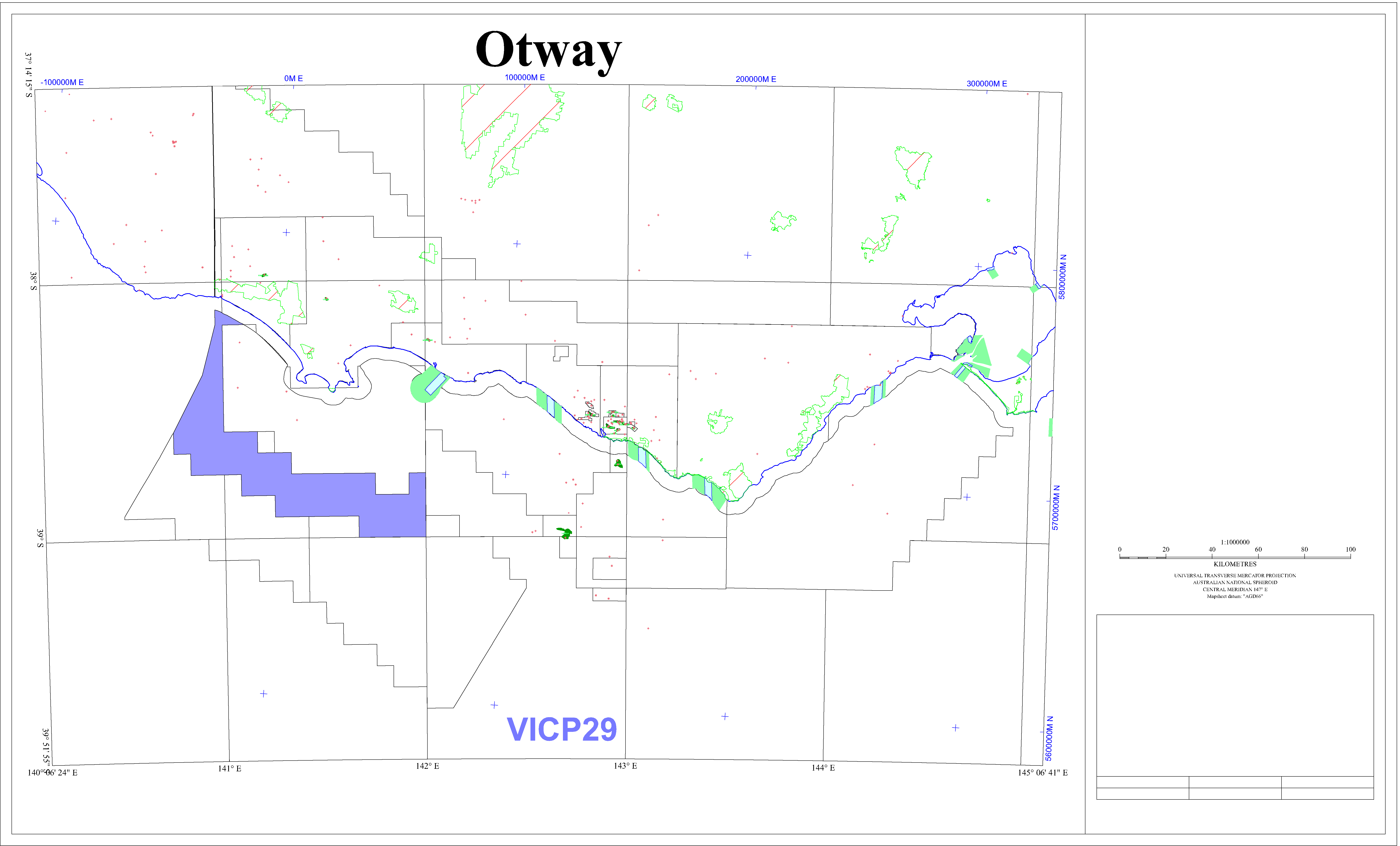 Petrosys Mapping POLYGON data file in AGD66 : ../peimages/vicp29_agd66.ply
(Image) file: vicp29.png
Petrosys Mapping POLYGON data file in AGD66 : ../peimages/vicp29_agd66.ply
(Image) file: vicp29.png